HUMAN IMPACT - Cultural Heritage
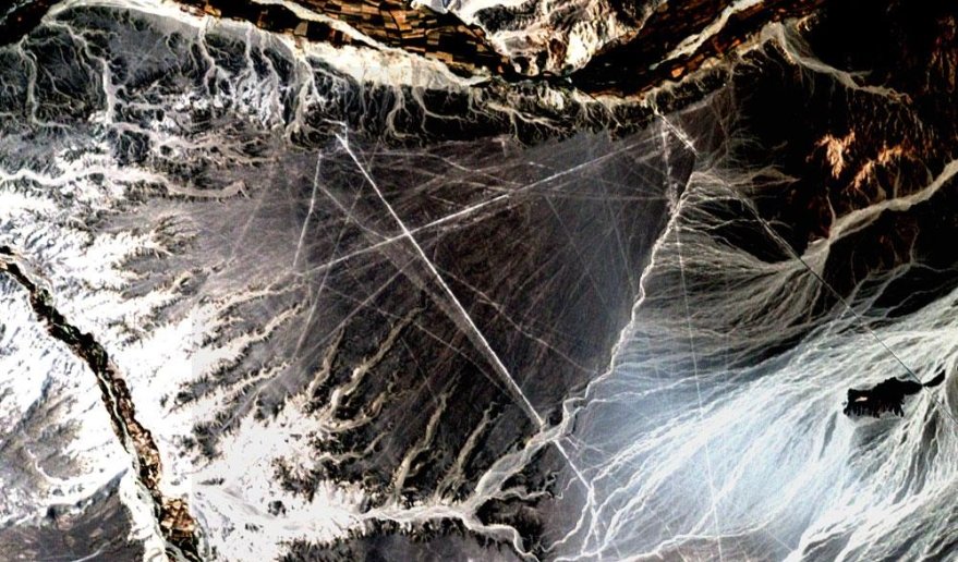
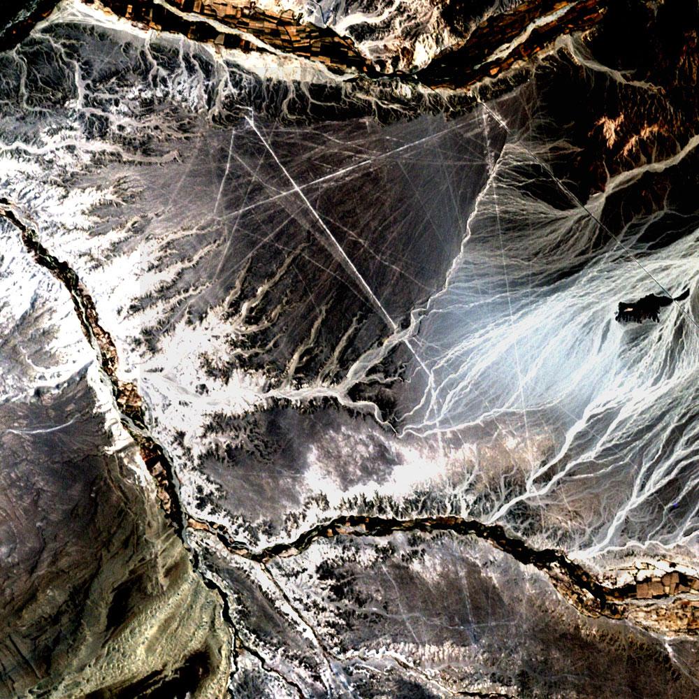
Nazca lines (Peru).
ETM+/Landsat 7 (10/11/02).
Source: Landsat USGS
gallery.
Space archaeology
In southwest Peru lies a dry plateau exhibiting some mysterious archaeology.
This Landsat image shows some of the thousands remarkably straight lines etched during kilometers onto the desert's surface. The site also contains huge pre-colombian geoglyphs (animals, plants, geometric figures, spiral patterns).
Known as the Nazca lines, those drawings are only visible from the air and remain unexplained by scientists.
The Nazca lines were declared UNESCO World Cultural Heritage in 1994.
Question: How is remote sensing useful to preserve cultural Heritage ?