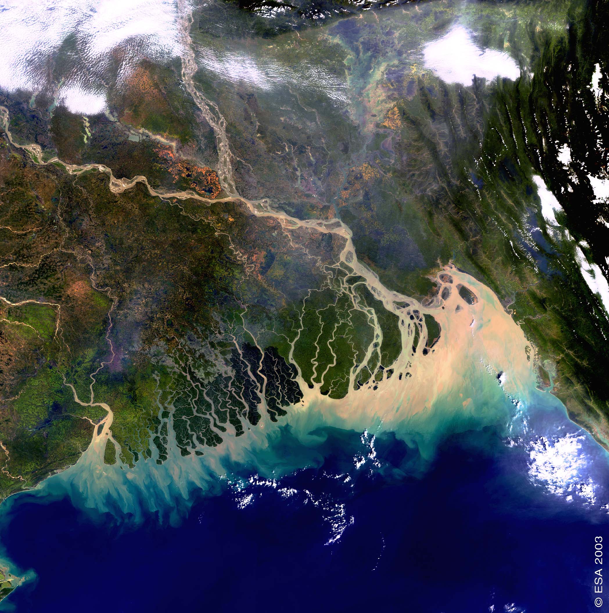
WATER - Coastal zones
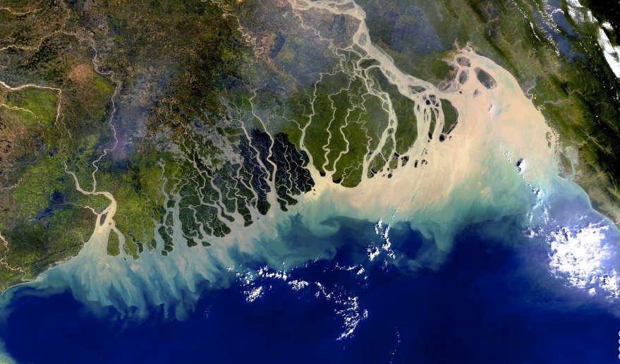
Bangladesh coastline.
MERIS/Envisat (08/11/03).
Source: ESA.
Sea isn't always blue
This colourful view of the Bangladesh coastline was taken by the European satellite Envisat.
Most of Bangladesh lies within the broad delta formed by the Ganges River and the Brahmaputra River.
Several distributaries form a vast network of waterways which hosts the Sundarban, the largest mangrove forest of the world.
Because sediments form large deposits into the Bay of Bengal, as can be seen in the brown water colour in the image, the delta expands continuously.
Question : Why is the study of ocean colour in coastal zones important ?