AIR, WATER and CLIMATE - El Niño and La Niña

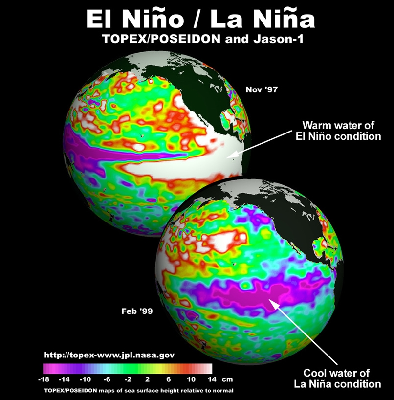
Height of ocean surface.
TOPEX/POSEIDON-Jason 1
data (Nov.97 and Feb.99).
Source: NASA/JPL.
Following El Niño
These images were produced using sea surface height measurements taken by satellites.
The red and white colour of the eastern tropical Pacific in the upper image indicates higher than normal ocean level due to piling up of warm ocean water during El Niño.
The lower image shows ocean level during La Niña when there is cool water from upwelling in the eastern tropical Pacific.
This oscillation of the ocean-atmosphere system has severe weather and socio-economic impacts for the whole planet.
Question: How do we know oceans are not flat ?