LAND - 3D models
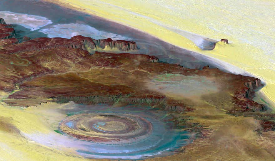
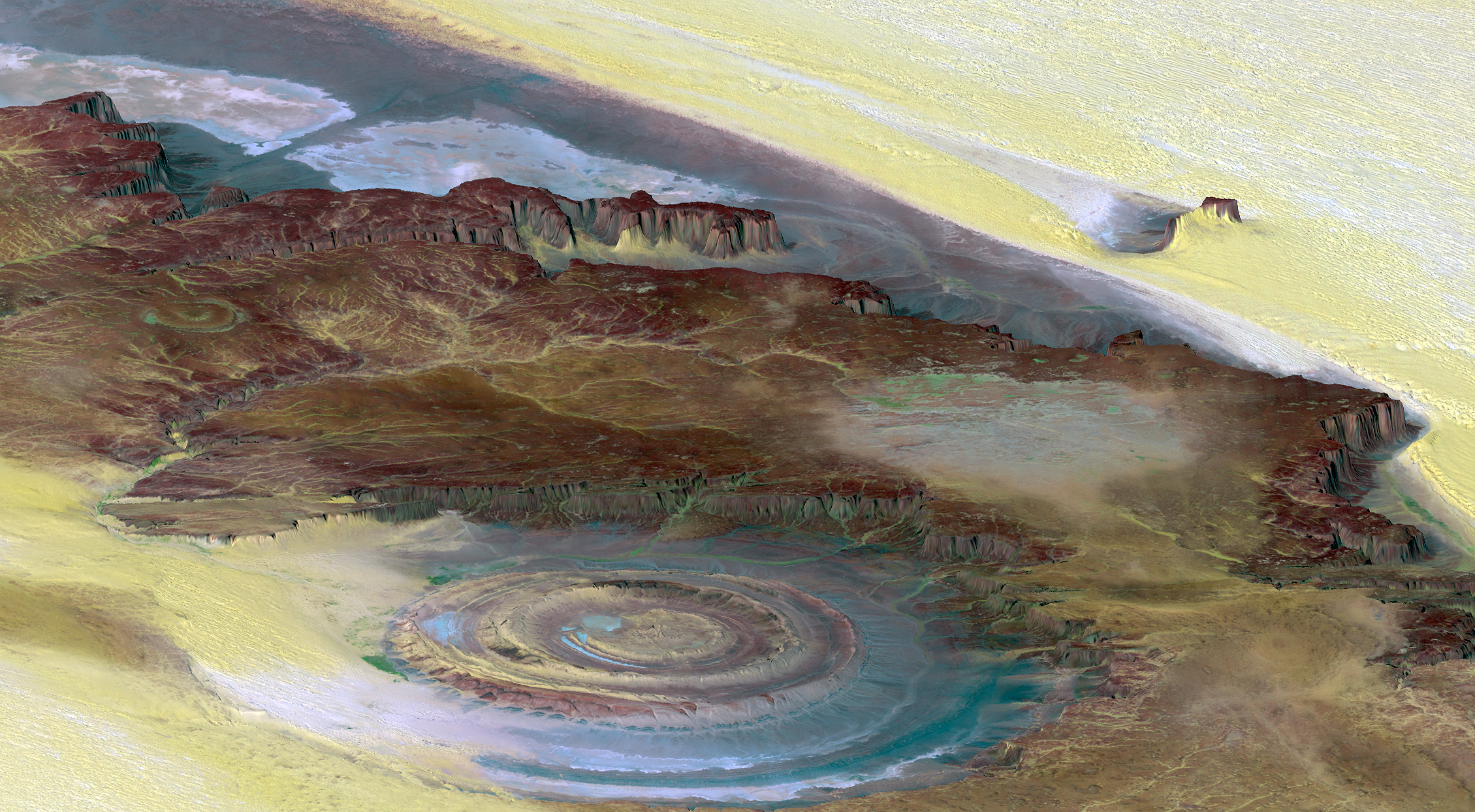
Richat Structure
(Mauritania).
Landsat (13/01/87) and
SRTM (01/02/00).
Source:
SRTM Team NASA/JPL/NIMA.
Giving height to landscapes
This 50 km-wide circular feature in the Sahara desert is known as the Richat Structure. Initially mistaken for a possible impact crater, it is now known to be an eroded structure of layered sedimentary rocks.
This 3D view was generated from a satellite image draped over an elevation model. The heights have been exaggerated 6 times to enhance topography.
Browns refer to bedrock, yellow/white to sand, green to vegetation and salty sediments appear in bluish whites.
Question : Do satellites "see" in 3D ?