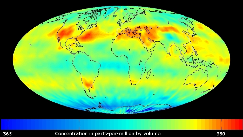
AIR, HUMAN IMPACT and CLIMATE - Global change
Monthly average mid-
tropospheric CO2.
AIRS/Aqua (July 2003).
Source: NASA/JPL.
Remote sensing to measure carbon dioxide
Carbon dioxide (CO2) is the most important greenhouse gas that is increasing in concentration because of human activities.
Climate modelers use satellite data to study CO2 global distribution and transport and to improve their models.
The map shows patterns of high CO2 (in red) especially in the Northern hemispher. And indeed, release of CO2 from fossil fuel burning is higher in the Northern hemispher than in the Southern hemispher.
Question: Can satellites measure global change ?