HUMAN IMPACT - Precision farming
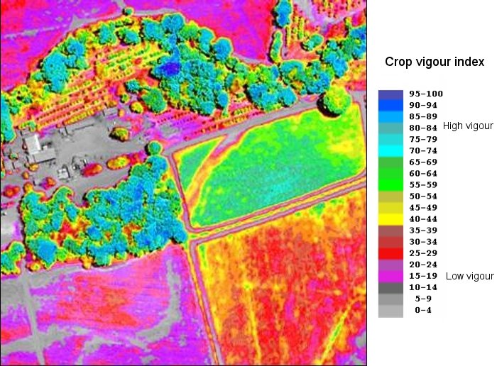
Vegetation vigour.
Quickbird data.
Source: DigitalGlobe.
When satellites and tractors work side by side...
In this image, blue indicates high vegetation vigour, while yellow is moderate vigour and red is low vigour.
Local low crop vigour can be the indication of water deficiency, presence of pests or fertilization need.
In precision agriculture, farmers use this type of detailed satellite data to pinpoint problems with drainage, insects and weeds.
They can learn where fertilizers are needed - and where they're not. They can discover pests - and spray only the infested areas.
Question : How can satellite sensors "see" crop health ?