6. Stromen metingen
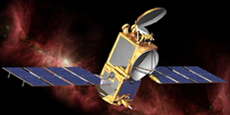
De satellieten Jason, Topex-Poseidon en Sentinel-6 zijn allemaal uitgerust met radarhoogtemeters. Deze sensoren werken door een microgolfpuls naar het aardoppervlak uit te zenden en vervolgens te meten hoe lang het duurt voordat de puls terugkaatst. Aan de hand van deze gegevens kunnen oceanografen de hoogte van de oceaan berekenen en vervolgens de snelheid en richting ervan bepalen. Zo kunnen we op wereldschaal en over een lange periode onschatbare kennis opbouwen over oceaanstromingen aan het oppervlak en stromingen die het oppervlak beïnvloeden.
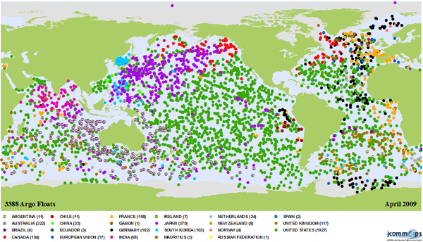
Een Argo-boei is ongeveer 1,1 m hoog, weegt ongeveer 25 kg en kan tot een diepte van 2000 m functioneren; de levensduur bedraagt ongeveer 4-5 jaar. De boei kan zijn drijfvermogen aanpassen om met de stroming mee te drijven en meet temperatuur, zoutgehalte en diepte. De drijvers komen elke 7-10 dagen aan de oppervlakte om gegevens naar satellieten te verzenden. Op dat moment kunnen we vastleggen waar ze zijn geweest en de eigenschappen van het water waarin ze zich hebben verplaatst, analyseren. Zo kunnen we veel informatie over oceaanstromingen afleiden. (Het programma heet Argo als aanvulling op de Jason-satellieten, omdat Argo de boot was waarin Jason met zijn argonauten voer.)
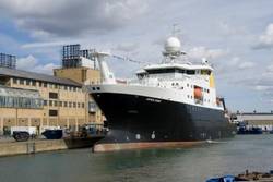
Het schip RV James Cook, aangemeerd bij het National Oceanographic Centre in Southampton.
Bron: Mike Conquer, NOCS
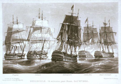
Grote zeilschepen van het type waarmee drijfgegevens werden geregistreerd.
Bron:
Wikimedia
Hoewel satellietgegevens ons veel kunnen vertellen over hoe de oceanen in de loop van de tijd veranderen, kunnen zelfs de allerbeste gegevens ons niet vertellen wat er dieper in de oceaan gebeurt. Om dit te onderzoeken, maken oceanografen gebruik van drijvers, schepen en verankeringssystemen. Wetenschappers gaan voor langere tijd aan boord van schepen de zee op om (onder andere) oppervlakte- en diepe stromingen te bestuderen.
Vroeger baseerden oceanografen zich bij het berekenen van zeestromingen op gegevens die waren geregistreerd door schepen terwijl deze tijdens het varen afdreven. Deze gegevens werden door marineschepen over de hele wereld verzameld en worden vandaag de dag nog steeds gebruikt in sommige oceanografische onderzoeken. De gegevens over het afdrijven van schepen vormen onze langste tijdreeks voor zeestromingsgegevens; satellieten en drijvers bestaan immers nog niet zo lang!
Tegenwoordig worden onderzoeksvaartuigen ingezet om stromingen te meten met behulp van op de romp gemonteerde akoestische Doppler-stromingsprofilers, en worden er vaak ook andere methoden voor het meten van oceaanstromingen toegepast, waardoor ze een essentieel onderdeel vormen van het oceanografisch onderzoek.

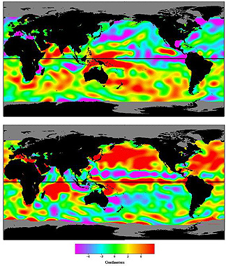
Gegevens over de druk op de oceaanbodem afkomstig van GRACE
Bron:
NASA/JPL
Druksensoren kunnen worden gebruikt om grootschalige oceaanstromingen indirect te bestuderen. De druk op de oceaanbodem wordt bepaald door de massa die erboven ligt. Wanneer oceaanstromingen en oppervlaktewinden water boven de druksensor verplaatsen, verandert de druk. Hierdoor kunnen we het zeeniveau bepalen en daarmee ook waar het water vandaan komt en naartoe stroomt.
Het is ook interessant om op te merken dat de GRACE-satellietmissie sinds 2009 goede beelden van de druk op de oceaanbodem begint te leveren.
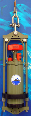
Een vastgemonteerde stromingsmeter
Bron:
Wikimedia
We kunnen stromingsmeters aan boeien vastmaken om de stroming en richting van het water langs de sensor te meten. Dit levert ons informatie over het wateroppervlak op en we kunnen ook verdere instrumenten aan de kabel bevestigen om op verschillende dieptes metingen te verrichten. Daarnaast is er een apparaat dat een ‘moored profiler’ wordt genoemd en dat langs de verankeringskabels op en neer kan bewegen om het volledige bereik van zoutgehalte, temperatuur en stroming te meten.
Er kunnen ook verankerde drijvers worden gebruikt die luisteren naar vaste sonarimpulsen en lokale omstandigheden registreren; deze verankerde drijvers kunnen hoogwaardige langetermijngegevens over stromingen opleveren. Ze zijn bijzonder geschikt voor het bestuderen van grensstromingen en wervelsystemen.
Oppervlakteboeien hebben het nadeel dat ze zeer kwetsbaar zijn voor schepen en weersomstandigheden aan het oppervlak, die de boei kunnen beschadigen of verstoren. Ondertussen kunnen ondiepe onderwaterverankeringen ten prooi vallen aan vissersvaartuigen. Voor diepe gebieden of plaatsen waar we zeer gedetailleerde langetermijngegevens nodig hebben, zijn deze technologieën van onschatbare waarde
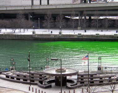
Er is kleurstof in de Chicago River geloosd; terwijl de kleurstof zich verspreidt, kun je de uitstroom volgen. (In dit geval werd de kleurstof geloosd ter gelegenheid van een festival, maar het principe is hetzelfde!)
Bron:
Wikimedia Commons
Vanuit oceanografisch oogpunt is een kleurstof een soort tracer. We beschouwen alles waarmee we een oceaanproces kunnen volgen dat anders onzichtbaar zou zijn, als een tracer. Het is mogelijk om kleurstoffen te gebruiken om lokale oppervlaktestromingen te meten. De kleurstof wordt in het water geloosd en de verspreiding ervan kan ter plaatse, vanuit een vliegtuig, via watermonsters of soms zelfs via satelliet worden gevolgd.
Er zijn echter nog veel andere, minder zichtbare manieren waarop we tracers kunnen gebruiken om de oceaan te monitoren. Oceanografen kunnen watermassa’s volgen aan de hand van hun zoutgehalte, potentiële temperatuur, zuurstofgehalte, kooldioxidegehalte en nutriëntenbelasting. We kunnen ook kijken naar de verspreiding van fytoplanktonbloei en rivierafvoer. Het is zelfs mogelijk om radioactieve isotopen te gebruiken om een watermassa te volgen door monsters te nemen en de chemische samenstelling van het water te onderzoeken. Zelfs een olielekkage kan als tracer dienen.
Het is de moeite waard om op te merken dat het volgen van water met tracers niet per se eenvoudig is. Watermassa’s staan in wisselwerking met elkaar en vermengen zich, en biologische organismen kunnen bestanddelen uit het water opnemen of erin afgeven. Deze parameters zijn echter nog steeds een zeer goed hulpmiddel voor het bestuderen van stromingen in de oceaan.
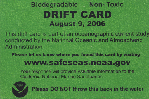
Driftkaarten worden meestal gebruikt om relatief lokale stromingen in kaart te brengen. Een organisatie laat biologisch afbreekbare kaarten drukken die op een vastgestelde plek in de oceaan worden gegooid. Wanneer deze aanspoelen en mensen ze vinden, kunnen ze per post worden opgestuurd of hun locatie online worden geregistreerd, zodat onderzoekers weten waar ze zijn gevonden.
Oceanografen weten dan hoe lang het heeft geduurd voordat de kaart is aangekomen en kunnen dit bijvoorbeeld gebruiken om te modelleren hoe vervuiling (bijv. olie) of uitheemse plantensoorten zich met de stroming zouden verspreiden.
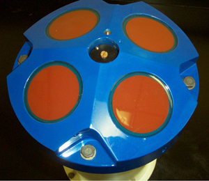
Een akoestische Doppler-stromingsprofiler, of ADCP, wordt gebruikt om te meten hoe snel het water door de gehele waterkolom stroomt. Ze kunnen op verschillende manieren worden ingezet. Een ADCP kan achter een schip worden gesleept, worden afgemeerd of aan de zeebodem worden verankerd (waarbij hij omhoog ‘kijkt’ naar het zeeoppervlak). Ze kunnen ook horizontaal worden bevestigd om de stroming over een (relatief) klein watergebied te meten.
Een ADCP werkt door een sonarimpuls uit te zenden en te ‘luisteren’ naar de terugkaatsing. Deze terugkaatsing is afkomstig van deeltjes in het water; als de deeltjes bewegen, treedt er een dopplerverschuiving op. Aan de hand van de mate van deze verschuiving kunnen de snelheid en de richting van de waterstroom worden berekend, waardoor we gedetailleerde, plaatsgebonden informatie over de stroming krijgen.
Telephone, power and internet cables are all laid across the sea floor. These cable are pulled around
by ocean currents and drift with flows. The drift of these cables can be used to supplement other data or to
help predict were best to lay a new cable to avoid it snapping.
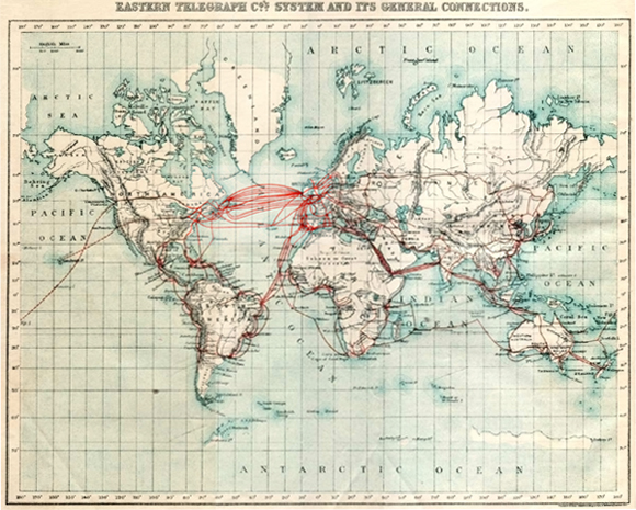
A 1901 map of submarine cables, as you can imagine there are a lot more now!
Bron:
Wikimedia Commons.
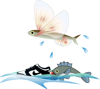
In mei 1990 sloeg een storm ten zuiden van Alaska 21 containers van de Hansa Carrier, een containerschip dat onderweg was van Korea naar de VS. Vijf containers braken open, waardoor zo’n 61.000 sportschoenen en laarzen in de Noordelijke Stille Oceaan terechtkwamen.
Deze schoenen hadden allemaal een individueel serienummer, dat in de scheepslogboeken was vermeld. Hiermee was dit de grootste bekende lozing van genummerde voorwerpen in de oceaan; 2,6% van de schoenen werd teruggevonden en gebruikt om oceanografische modellen te verbeteren!
De badeendjes waren weer een heel ander verhaal, hoewel in dezelfde trant.
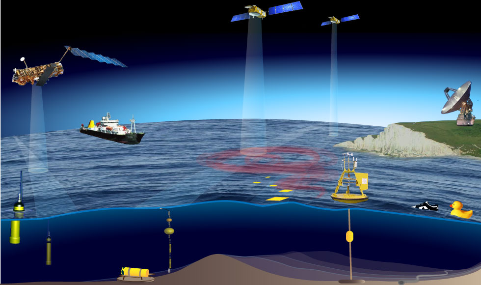
Klik op de afbeelding voor meer informatie over de verschillende methoden die worden gebruikt om zeestromingen te meten
Satellietmetingen en in situ metingen
Satellietmetingen geven ons een breed overzicht en laten zien hoe stromingen in tijd en ruimte variëren. We hebben echter ook gegevens nodig uit andere bronnen: instrumenten die op de zeebodem zijn verankerd (verankeringspunten), die met de stromingen meedrijven (drijvers) of die zijn gemonteerd op boeien, platforms en schepen.
Samen kunnen deze verschillende metingen ons helpen begrijpen wat de waterstroom in de oceaan en langs onze kusten beïnvloedt.
De metingen kunnen worden gecombineerd met numerieke modellen die worden gebruikt om het transport van sediment of verontreinigende stoffen te voorspellen of om te onderzoeken hoe het oceaansysteem zou kunnen reageren op externe veranderingen, zoals de wereldwijde klimaatverandering.
Blijven waar je bent of meegaan met de stroom?
Traditioneel zijn er twee directe manieren om stromingen te meten: je kunt iets aan het water toevoegen en volgen hoe het zich verplaatst (Lagrangiaanse metingen), of je kunt een instrument op een vaste positie plaatsen en meten hoe snel de stroming erlangs stroomt (Euleriaanse metingen). Een wiskundige analyse van deze twee methoden is te vinden op pagina 4 van
over differentiaalvergelijkingen en afgeleiden in de Inzicht in Spectra van de Aarde leereenheid.
Stromingen kunnen ook indirect worden gemeten: door andere parameters te meten en aan de hand daarvan de snelheid en richting van de stroming te berekenen. Oceanografen maken gebruik van al deze methoden om meer te weten te komen over de stromingen in de oceaan.
De bovenstaande afbeelding toont verschillende manieren om gegevens over de huidige snelheid en richting te verkrijgen. Volg de links in de afbeelding voor meer informatie over elke methode en bepaal of deze Lagrangiaans, Euleriaans, indirect (afgeleid van andere parameters) of misschien een combinatie daarvan is.
