3. 3D Applications
Orthophotos
If you have read the chapter about perspective projection,
do you think this kind of projection is suitable for constructing a
topographic map?
Let's find out in this chapter!
Take a look at following images of Chicago and Washington D.C. in the United States.
Which image do you think will be the most useful for creating a topographic map? Why?
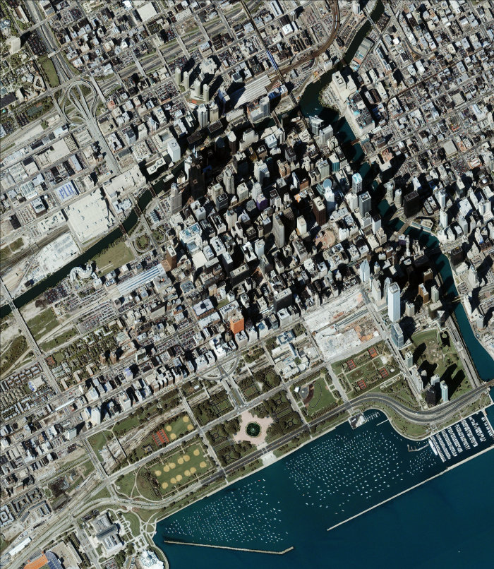
Source: © 2009 GeoEye
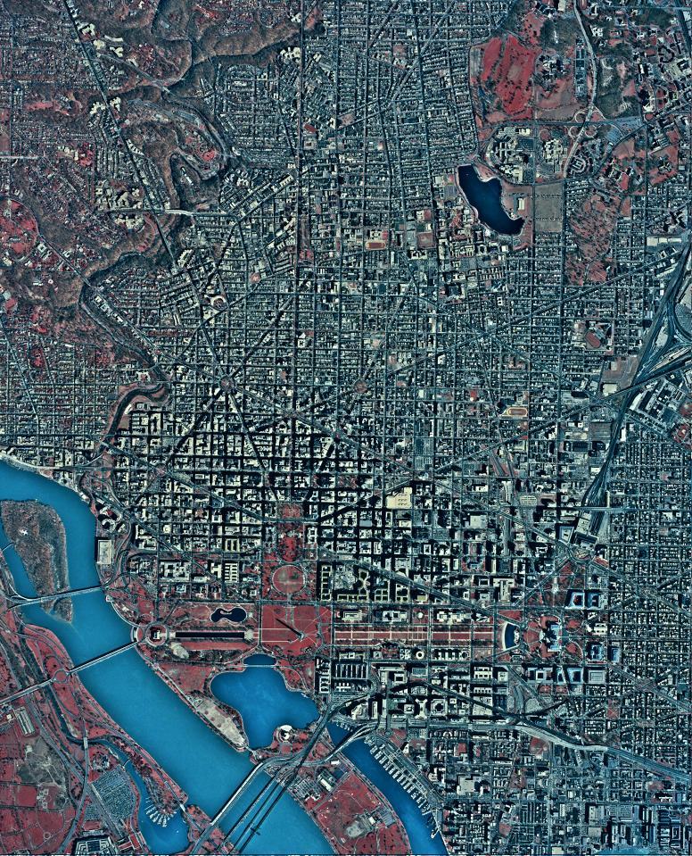
Source: USGS
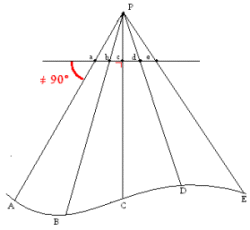
90 degrees or not?
You probably noticed the difference between both images, but maybe it is difficult to explain exactly what is happening. Therefore, let us put it into a more theoretical way.
- In the first situation, the plane/satellite takes an image from a part of Chicago, forwards, backwards or
sideways from its current location (the perspective centre (point P) in the air/in space.
This means that the image was made at an angle that is less than 90°.
As seen before, this projection is called the perspective projection.
 Perspective projection.
 - The second image gives you the impression that this is what you see when the plane/satellite
(and thus the perspective center) is located right above each feature in the image, which means under an
angle that is exactly 90°.
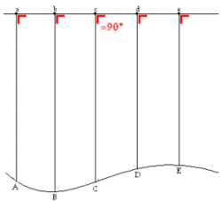 Orthographic projection.
But in an aerial photograph or satellite image, which is always a perspective projection, there is only one point in the image where such a view is possible: the point just underneath the perspective center/camera lens (point D in the first image). All the other points in the image are taken under a certain angle, which means that a distortion takes place.
To be able to work with satellite images (direct and accurate measurements of distances, angles, positions and areas), it is much easier to have images like the second image of Washington. Otherwise the image distortion has to be taken into account in the calculations.
The good news is that a process to correct the deformation induced by the perspective projection, called orthorectification, can be applied to remotely sensed images. Orthorectified images are often called orthophotos.
