3. 3D Applications
Digital Elevation Models (DEM)

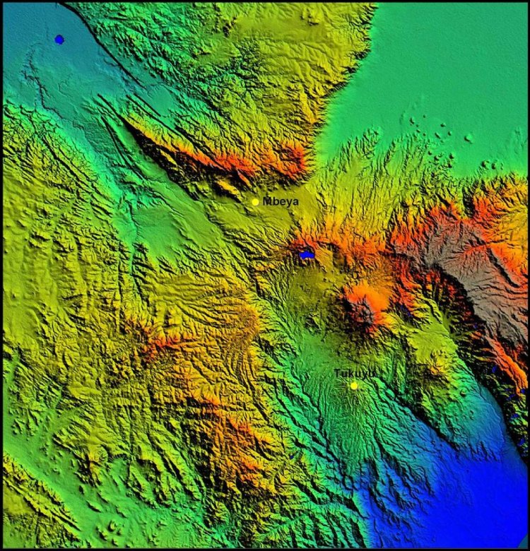
Source: © Satellite Imaging Corporation. All rights reserved.
A digital elevation model (DEM) is a digital representation of a terrain surface. It is also known as a digital terrain model (DTM).
As the name implies, the elevation (also called height or altitude) is the main parameter that is displayed in the DEM. But before the elevation (z) at a specific location can be determined, a reference system for its horizontal position (x,y) has to be pointed out. The most commonly used geographic coordinate systems are UTM (Universal Transverse Mercator) and the latitude-longitude coordinate system.
How do you construct a DEM?
To create a DEM, the elevation (z) of every location in the area is needed. Because it is not possible to survey them all, only some locations, the so-called grid points, are stipulated, where the elevation is accurately measured. It means that at these locations, all three parameters (x, y and z) are known.
To determine the elevation of the remaining coordinates, interpolation is needed. The closer together the grid points are located, the more detailed the information will be in the DEM. The details of the peaks and valleys in the terrain will be better modelled with small grid spacing than when the grid intervals are very large. Elevations other than at the specific grid point locations are not contained in the DEM. As a result peak points and valley points which do not coincide with the grid will not be recorded in the DEM.

Questions:
Have a look at the above figures. The red lines symbolise DEMs trying to represent a terrain surface (in black).
- Which of the DEMs fits the curves of the terrain more accurately? Which interpolation is better and why?
- What is indicated by the blue arrow?
Other sensors onboard satellites can be used to create DEMs
Some active instruments, like lasers can also be used to create DEMs. The laser sends out a laser beam that bounces on the surface of the Earth and is transmitted directly to the satellite. The time it takes to return to the satellite is measured, which makes it possible to calculate its distance to the surface. This Laser does this over and over, methodically mapping out the surface of the area.
