2. Some Basic Principles
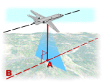
Relief Displacement
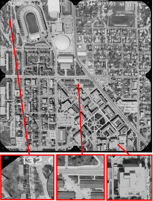
Source: Purdue University
Take a look at the buildings on the detailed images of the aerial photograph above.
- Do you see anything remarkable about the position of the top and bottom of the buildings?
- How does this position change depending on the location in the aerial photograph?
How come?
You probably noticed that, except for the features on the nadir point, the buildings are perceived under a certain angle and that this angle changes depending on the location in the image. The following figure illustrates how this came about.
Source: Purdue University
This relief displacement underlie the following principles:
- Objects will tend to lean outward, i.e. be radially displaced.
- The taller the object, the greater the relief displacement.
- The further the object is from the principal point, the greater is the radial displacement.
Relief displacement can be hundreds of metres. For example, if the IKONOS satellite sensor acquires image data over an area with a kilometre of vertical relief, with the sensor having an elevation angle 30° from Nadir, the image product will have nearly 600 metres of relief displacement!!
Something to think about...
- If you have read the chapters about perspective projections and orthographic projections, in which projection is relief displacement more likely to occur?
- If you compare a map with a photo, which one is more likely to show relief displacement?
Could it be possible to calculate the height of a building out of the relief displacement? Find it out here!
