6. Measuring Ocean Currents
Radar Altimetry
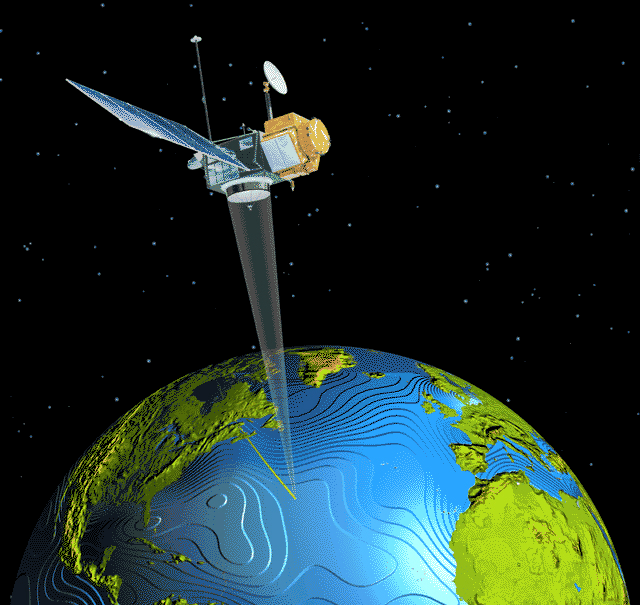
Altimeters have a parabolic antenna facing earthwards (see figure), and work by transmitting a pulse of microwaves towards the surface (just like any other radar), and measuring the time that the pulse takes to bounce back to the satellite. The longer the time, the longer the distance between satellite and sea surface.
To turn this distance into a useful measure of sea level requires a number of ‘tricks’:
- First of all, the orbit of the satellite must be know with almost incredible precision – we need to know where it flies (some ~1000 km over the surface) with an error of the order of 1 cm!
- Then we need to account for the fact that the microwave pulse is slightly slowed down by the ionosphere, the atmospheric gases and water vapour.
- Even after these complicated corrections, the derived sea level is not solely due to currents: there is an additional contribution by the tides, plus the effects of local variations in atmospheric pressure. These extra components are removed using accurate tidal model and atmospheric pressure models
- In the end satellite oceanographers obtain precise measurements of the sea level profile along the ground tracks of the satellite.
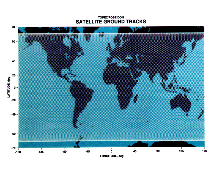
Each ground track is only a few kilometers wide, but in just a few days they form a fine mesh over the globe. The time taken to cover the entire globe depends on the orbit characteristics; for TOPEX/POSEIDON and Jason-1, two of the most popular altimeters, it is 9.92 days.
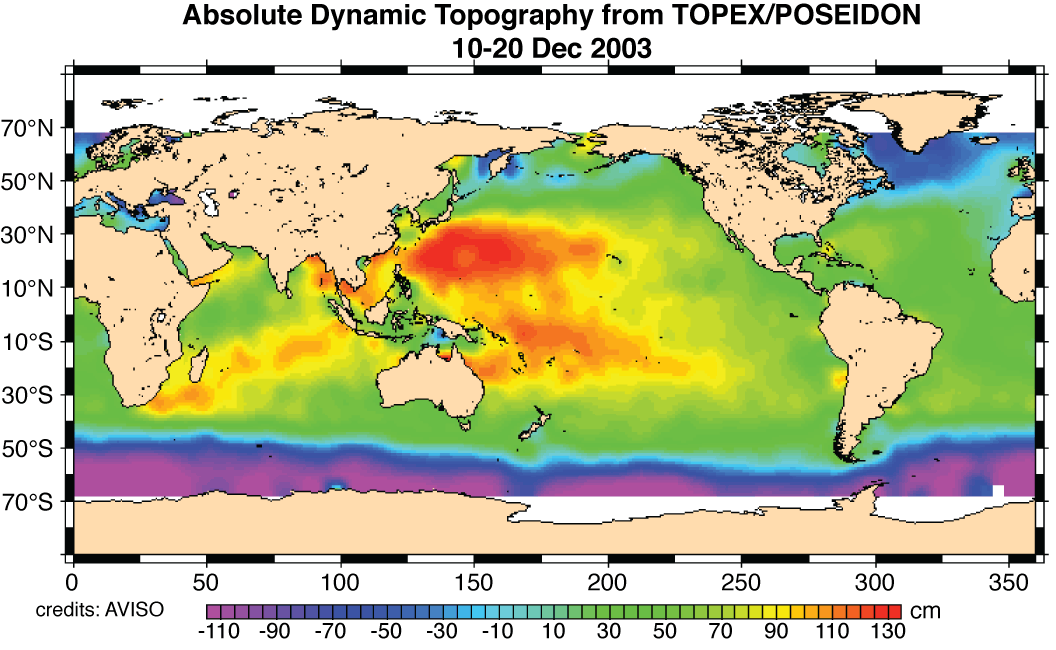
Many users of satellite altimetry want the measurements as maps on a latitude/longitude grid. That means filling in the gaps between the long, thin lines of actual measurements. This is done with sophisticated mathematical techniques, often merging the measurements taken from several altimeters on different satellites. The final result are gridded maps of Sea Surface Height, one map every 7 or 10 days. Such maps make it possible to calculate the slope of the sea surface.
If you are interested in exactly how oceanographers get from maps of sea surface height to measurements of ocean currents, the following pages of extra information will help:
