6. Measuring Ocean Currents
Eddies: the Oceanic Storms
From surface slope to current speed
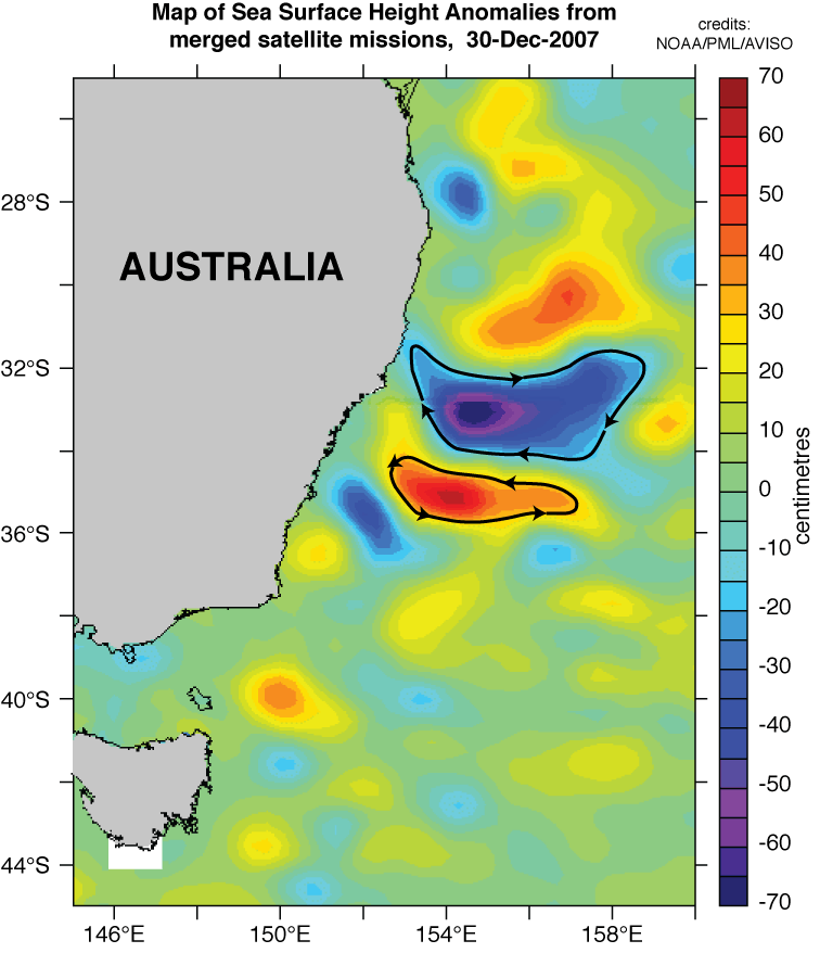
Alongside the major currents, the sea surface is scattered with rotating vortices, called eddies. These circular-shaped or elongated features, 50 to 300 km wide, are the oceanic analogy to storms in the atmosphere, and are clearly seen in maps of sea surface anomaly from altimeters. Eddies are subject to the Coriolis force and to a good approximation can be considered geostrophic
- so that a warm anticyclonic eddy (i.e a positive bump in the sea surface) will rotate clockwise in the Northern Hemisphere, anticlockwise in the Southern Hemisphere,
- while a cold cyclonic eddy (a depression in the sea surface) will rotate in the opposite direction.
The same happens for anticyclones (high pressure) and cyclones (depressions) in the atmosphere.
Importance of eddies
Eddies are important both for ocean circulation and climate, as they transport heat and momentum, and for biology and fisheries, and they mix different oceanic waters influencing the conditions that allow the marine food web to develop. Moreover they may be important for shipping, as explained in the diagram below, negotiating the wrong side of an eddy may well mean losing a couple of knots in speed.

