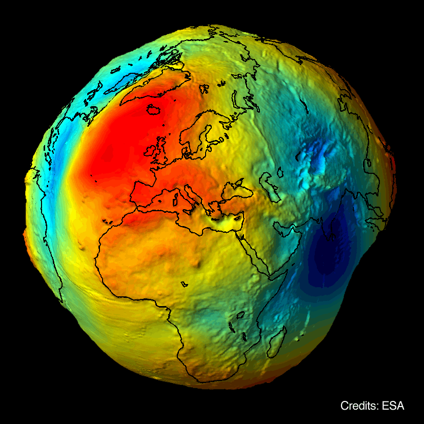
The Geoid
Removing the effect of Earth’s gravity
There is one extra obstacle when trying to measure currents with an altimeter. We have seen already that with the altimeter we measure height and compute the slope, then convert it into geostrophic current. The catch is that one large component (in fact, the largest) of the sea surface height does not come from ocean currents but rather from the variation of the earth’s gravity field due to the internal composition of our planet.
Even if there were no currents, the sea surface would still be rather bumpy, with variations of ±100 m (over very long distances, of the order of thousands of kms) compared with a smooth ellipsoidal shape, because gravity varies from place to place: where it is stronger it will pull more water and there will be a bump, where it is lower there will be a trough. The no-motion surface that the sea would assume in absence of currents is called the geoid.
Vague about the geoid?
The large undulations in height due to the geoid must be removed to reveal the much smaller signals due to currents. but... we do not know the geoid accurately enough! Therefore, until recently oceanographers had to be content only to measure how sea surface height varied in time with respect to the mean sea level – and these variations surely are due to changing currents, because the geoid does not change with time! So we could only measure current differences with respect to their mean value (or as oceanographer say, current anomalies), and not absolute currents.
New gravity satellites will help
This picture is quickly improving as new satellite missions (GRACE and GOCE) are measuring the gravity field and the geoid itself with much greater accuracy – therefore allowing the subtraction of the geoid and the computation of absolute currents.
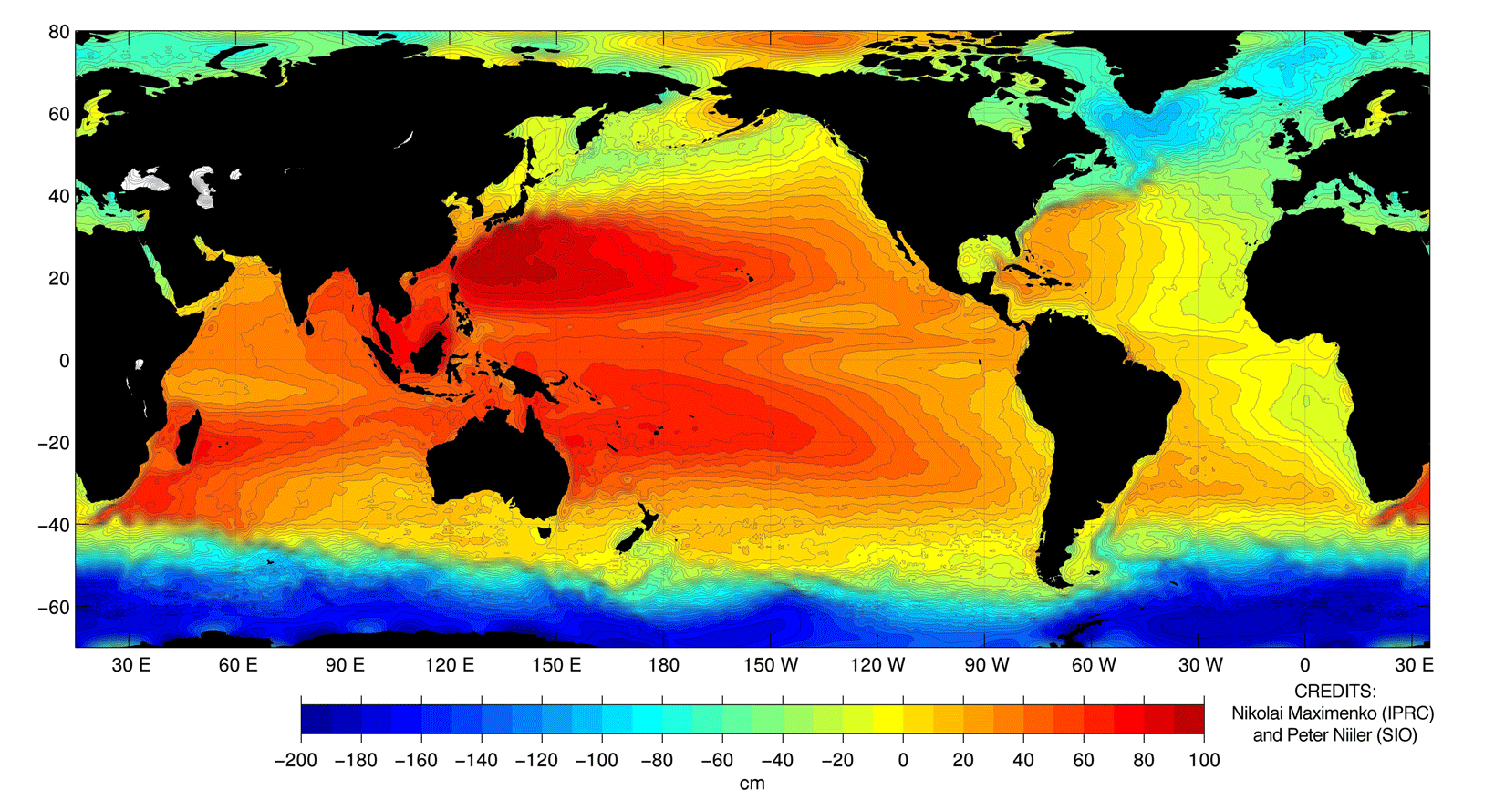
One recent example (2005) of this computation, by Maximenko and Niiler is shown above, in the form of a map of Mean Dynamic Topography of the Sea Surface, i.e. the topography due solely to currents, with the geoid removed. Notice that the 'steepest' regions, where the variation in level is sharper, correspond to the position of the strongest currents like the Gulf Stream, the Kuroshio and the Antarctic Circumpolar Current, as you would expect from geostrophy.
