Geostrophic Currents
From surface slope to current speed
You may wonder how an oceanographer converts measurements of the surface slope into a measure of the current speed. The basis assumption is that when we look at the large currents over scales of 100 km or more there is a substantial equilibrium between two forces – the pressure gradient and the Coriolis force that you have seen in chapter 2.
To understand this, have a look at the figure below.
Imagine for a moment that there is a ‘high’ and a ‘low’ in the sea surface (an altimeter can measure these!) and that there is no Coriolis effect. Water would naturally flow from the high to the low in order to restore the equilibrium. In other words there is a force that pushes the water from the high level to the low level – and this force if proportional to the difference in levels i.e. the ‘pressure gradient’.
But now consider that in the real world the Coriolis force IS there – and it will pull the current to the right in the Northern hemisphere (as you see in the figure below) and to the left in the Southern hemisphere.
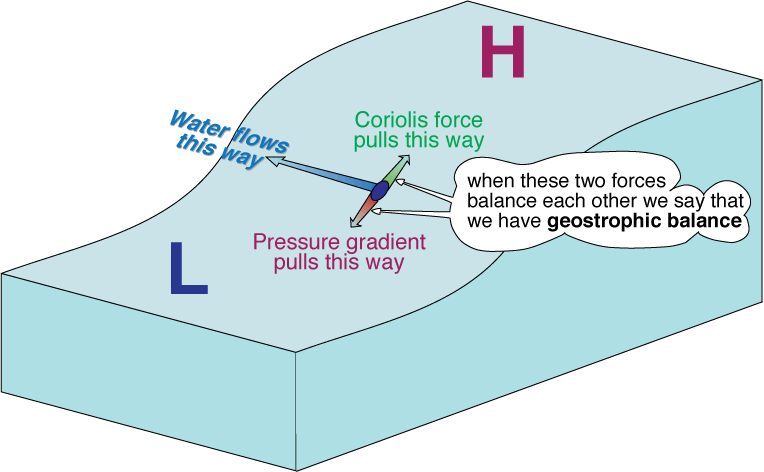
When the situation is as depicted in the figure above, we say that there is geostrophic balance, and that the current is purely geostrophic. The nice thing is that the current can be readily computed from the measurement of the slope.
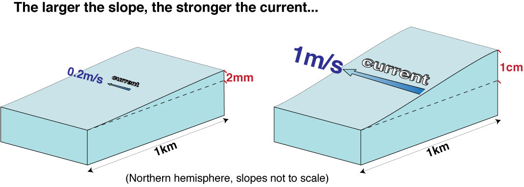
In fact the Coriolis force is given by the current speed v times a parameter f called the Coriolis parameter (the Coriolis parameter varies with latitude: at 45° its value is approximately 10-4 s-1), while the pressure gradient is the slope dh/dx (where h is height and x is distance) times g, the acceleration due to gravity (9.81 m s-2).
So if we simply write the geostrophic balance, i .e. we write
We can immediately compute v as
and the direction of the current will be perpendicular to the slope, as shown in the figure.
Not all currents are geostrophic
The assumption that there is geostrophic balance is only accurate when we look at the large-scale currents, i.e. at scales larger of a few tens of km. All the major currents can be considered geostropic to a first approximation. At smaller scales, the ageostrophic (non-geostrophic) components of the currents, for instance due to the forcing by the local wind, become more and more important. So for instance in several coastal areas the circulation is largely ageostrophic. An altimeter can however still be used to measure the geostrophic component.
