Remote Sensing of Cultural Heritage Sites
Dresden and the Elbe Valley in Germany (2/2)
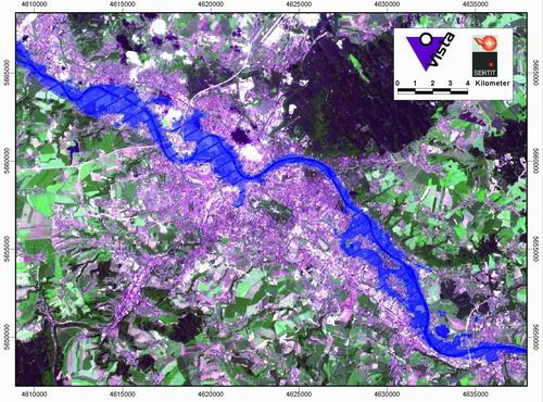
The maximum flood extent during the Elbe flood in Dresden obtained from a SPOT-4 image of 17th August 2002
superimposed on a SPOT-2 based satellite map.
Processed by SERTIT and VISTA GmbH. Spot Images. Copyright: CNES, 2002. Distributed by Spot Image.
Processed by SERTIT and VISTA GmbH. Spot Images. Copyright: CNES, 2002. Distributed by Spot Image.
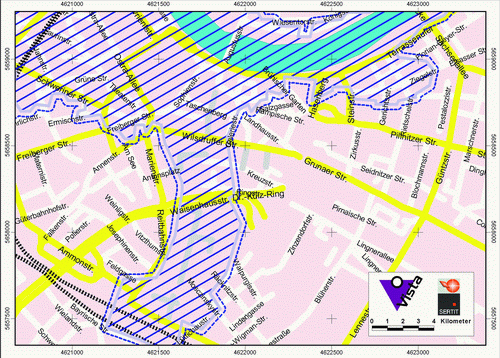
Maximum flood extent derived from SPOT analyses superimposed onto a street map of Dresden.
Source: VISTA GmbH and SERTIT
Source: VISTA GmbH and SERTIT
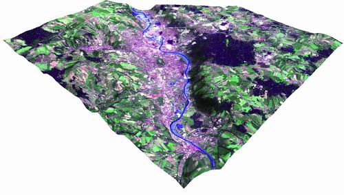
Mapping of flood extent over Dresden on 19th August 2002.
Envisat ASAR data overlain with SPOT-2 image map in pseudo natural colour.
Source: SERTIT
Source: SERTIT
