Remote Sensing of Cultural Heritage Sites
Venice, Italy (1/2)
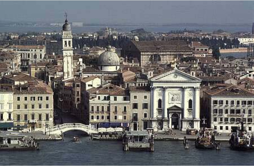
Founded in the 5th century and spread over 118 small islands, Venice became a major maritime power in the 10th century. The whole city is an extraordinary architectural masterpiece in which even the smallest building contains works by some of the World's greatest artists such as Giorgione, Titian, Tintoretto, Veronese and others.
In 1987 the historic centre of Venice, the whole lagoon with its hundreds of small islands, its three "gates", the Lido, Malamocco and Chioggia; its basins and fishing areas were inscribed on the UNESCO World Heritage List.
In this lagoon covering 50,000 km2, nature and history have been so closely linked since the 5th century A.D. when Venetian populations, to escape Barbarian raids, found refuge on the sandy islands of Torcello, Iesolo and Malamocco.
The links between Venice and the Emperor of the East facilitated the establishment of the Dalmatian Empire. At the end of the 10th century, when Venice was an independent ally of Byzantium, the city continued to establish a network of trading posts on the other side of the Mediterranean. In the context of the Crusades, it also founded trading posts at Sidon in 1102 and in Tyre in 1123. At the end of the 13th century, Venice was at the peak of its power.
The Turkish takeover of Constantinople in 1453 constituted a threat to the maritime empire of Venice. Despite this first setback, the city's economic prosperity was maintained and its urban landscape took shape during the 16th century. These temporary settlements gradually became permanent and the initial refuge of the land-dwelling peasants and fishermen became a maritime power.
The plan of Venice developed around its principal waterway, the Grand Canal, and is made up of a combination of sinuous forms that follow the meandering of the lagoon and rectilinear forms that cross at right angles.
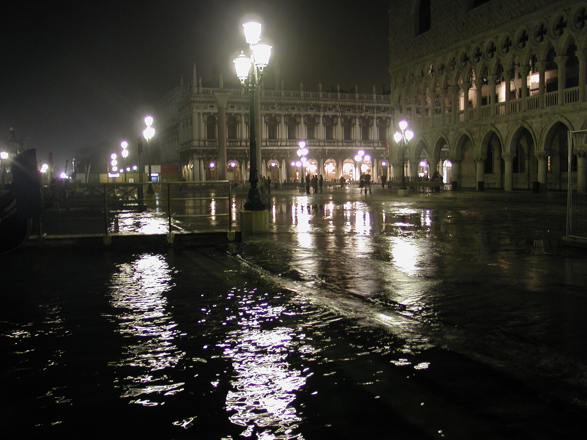
Land subsidence due to natural and anthropogenic causes has represented one of the most serious environmental problems for the Lagoon of Venice.
According to archaeological records, in the past Venice has been sinking at a rate of
about 10 cm per century as a result of natural the subsidence, i.e. the rise of water level
caused by delta propagation and compactness of sediments. But during the 20th century,
it lost an extra 10 to 13 cm because neighbouring industries were pumping groundwater
out of the Venetian aquifer system.
In the 1970s, after the regulation of groundwater exploitation,
a remarkable slowing down of the induced subsidence in Marghera (industrial zone),
in the historical centre of Venice and along the littorals was ascertained.
Recent studies have shown that land subsidence is still in progress in the southern
and northern coastal areas and in the nearby mainland.
In these areas groundwater is extracted from artesian wells, thicker and more compressible Holocene sediments are present, and organic soil oxidation takes place in reclaimed zones.
Land subsidence has made the area, a large portion of which lies below the mean sea level, increasingly vulnerable to geological hazards (i.e. river flooding, riverbank instability, intrusion of seawater in the aquifer system, deterioration of the littoral sectors with a general coastline regression and an increment of the sea bottom slope close to the shoreline). Due to this problem and probably also to climate change, the frequency of flooding has increased in the last years: between September 2000 and March 2001 alone, more than 40 floods were recorded.
