3. Resolution
Spatial resolution
Satellite sensors store information about objects as a grid. Digital data is collected from the area covered in the form of individual image points, so called pixels. A pixel is the smallest area unit in a digital image.
The size of the pixel is dependent on the sensor type and determines the resolution of the image. The measurement of the resolution is the edge length of a pixel. The higher the resolution and the finer the grid is, the larger is the degree of recognizable details on the earth's surface.
The resolutions of today's satellite systems vary from a few centimetres (for example military usage) to kilometres. Application:
- Low resolution: larger than 30 m
- Medium resolution: 2 - 30 m
- High resolution: under 2 m
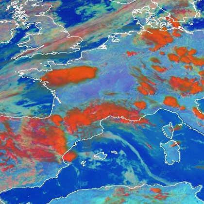
Low resolution of Western Europe - METEOSAT (1km).
Source: Copyright 2005 EUMETSAT
Source: Copyright 2005 EUMETSAT
Different satellites are designed and launched based on their intended use and orbit.
- A lower resolution usually coincides with a higher repetition rate, meaning that within a short interval (METEOSAT-8 for example every 15 min) the satellite investigates the same area. A "coarse" resolution is used to record large or global areas for climate-related enquiries, for example the radiation budget of the earth and for weather monitoring. Additionall applications include earth observation of land use and oceans, the ocean's ice cover and the surface temperatures.
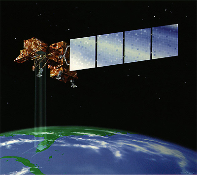
- Satellites with medium resolution such as LANDSAT 7 are used for the global observation of land surfaces. Tropical rainforests and their deforestation have been observed by the LANDSAT satellites for more than 30 years.
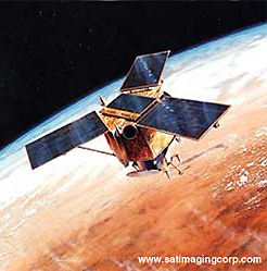
- High resolution data is mainly used for smaller areas of the earth's surface. Only recently such data has become available commercially and privately. Satellites such as IKONOS or QuickBird send data for topographic and thematic mapping of for example land use, vegetation, or as planning resources for cities, large projects etc. Information can also be "ordered" in advance, because the turning of the satellite sensors can reduce the repeat rates and can monitor the desired areas earlier (Albertz 2007, Löffler et al. 2005).
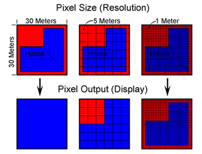
Spatial resolution.
Source: Satellite Imaging Corporation
Source: Satellite Imaging Corporation
