4. Mass Tourism
Case study Tenerife (2/8)
Land Use Change
Not only are cities and other settlements growing on Tenerife, but also other forms of land use or land cover are changing or being displaced by others. Get an overview of the land cover changes from 1978 until 2002.
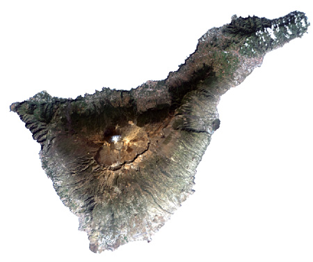
Tenerife 1978
Satellite image of Tenerife in 1978.
Source: Landsat
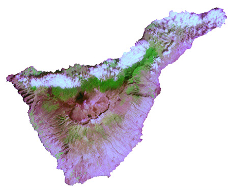
Source: Landsat
Satellite images can provide information about many aspects of the land's surface, which is used for several interpretations. To analyse land use and land use change over time, it is helpful to classify the satellite data.
Classification of satellite images