Comparison of Land Use in 1978 and in 2002
Here we can examine the land use respectively land cover change on the whole island in more detail. What has happened and where between 1978 and 2002?
Task: Compare the satellite image and the classification of Tenerife in 2002 by switching between the two images.
Tenerife 2002: Comparison of satellite image and classification
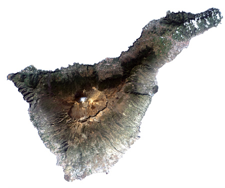
Satellite image of Tenerife in 2002.
Source: Landsat
Source: Landsat
Task: 1. Study the bar graph in the Figure below.
It illustrates the change of the land use resp. land cover in the particular land use and land
cover class from 1978.
a) What do the bars stand for?
b) In which land use resp. land cover class did the biggest changes occur?
c) In which class did the smallest changes occur?
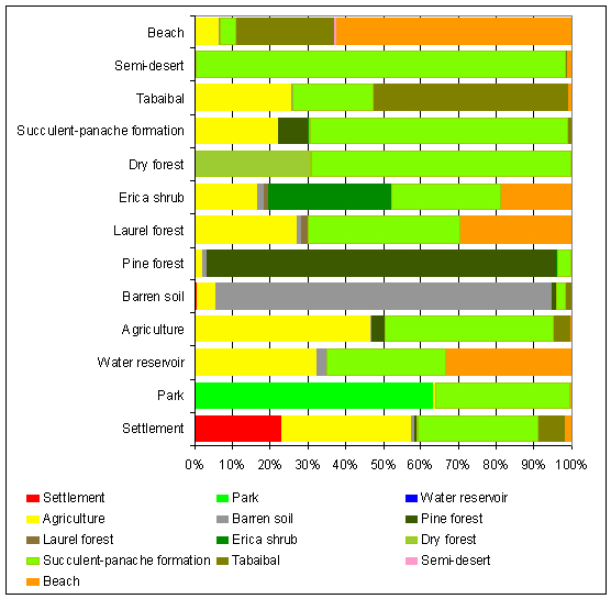
Compilation of land coverage and land use classes from 2002
of classes from 1978.
Source: Naumann 2008
Source: Naumann 2008
