Remote Sensing of Cultural Heritage Sites
Mont Saint Michel, France (2/2)
Contribution of Remote Sensing
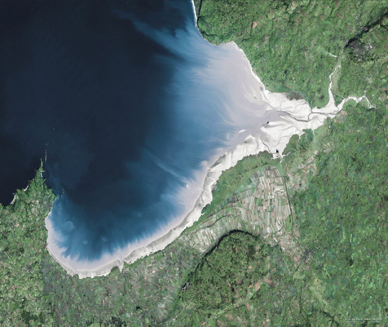
The Mont Saint-Michel Bay is characterized by an exceptional tidal amplitude: 14.5 m during spring tides. Associated with a very light northwest-trending slope, the width of the foreshore reaches 15 km along a NW-SE axis. The emerged foreshore can then be as much as 240 km2, that is, half the bay. More than 400,000 m3 of sediments accumulate in the bay each year. This equates to a sedimentation rate of about 1 mm per year. The fine parts contribute to the development of the halophytic vegetation on the wave-cut platform, whereas the coarse parts lead to the formation of large sand bodies and dunes.
Due to the link between local mean time and the higher tidal amplitudes, the sun-synchronous satellites allow to cover only 80% of the emerged foreshore in the better conditions (about 2.3 m of sea elevation). These particular conditions have been obtained for the first time on October 24, 2007 by the AVNIR-2 sensor onboard the Japanese Space Agency (JAXA) ALOS satellite. ALOS AVNIR-2 data was used for geological mapping including the channels and the identification of the main types of sediments (coarse sand, fine sand, mud, etc.). The wave-cut platform was also mapped on the basis with this satellite data.
Source: CNES/Distribution Spot Image/2003
Source: ESA
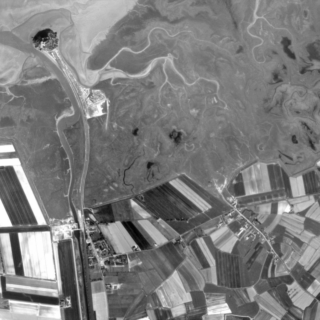
Mont St. Michel can be seen in the upper left hand corner. The small island is separated from the mainland by approximately one kilometre of sandbanks at low tide or waves at high tide.
Formerly, the only way to reach the islet from the mainland was by foot or boat, which could pose substantial risks with its great tidal amplitude. Today, a road links the islet to the mainland (visible).
ESA's Proba satellite acquired this image with its onboard panchromatic High Resolution Camera (HRC). Measuring just 60 x 60 x 80 cm, Proba performs autonomous guidance, navigation, control, onboard scheduling and payload resources management. Its other onboard imaging instrument is the Compact High Resolution Imaging Spectrometer (CHRIS). Together HRC and CHRIS have provided more than 10,000 images of more than 1,000 sites.
