LAND and HUMAN IMPACT - Deforestation
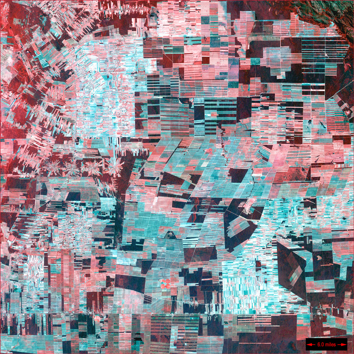
Deforestation in Bolivia.
ETM+/Landsat 7 (08/01/00).
Source: USGS EROS Data
Center Satellite Systems
Branch.
Satellites watch over our forests
This Landsat image shows dramatic deforestation of the Amazon rainforest.
Loggers have cut long paths into the forest, while ranchers have cleared large blocks for their herds. Fanning out from these clear-cut areas are settlements built in radial arrangements of fields and farms.
This is a false colour image where healthy vegetation appears dark red while rectilinear, light-coloured areas are fields and pastures.
Question : How does remote sensing contribute to sustainable management of the forest ?