6. Classification
Why do we classify data and satellite images? When a satellite image goes through the process of classification, a land use classification map is one possible outcome. This map can be more successfully "read" and interpreted with its limited number of classes for uses such as planning.
Individual elements (pixels) of a satellite image including its values (reflection values and greyscale values) can be referenced to a specific number of classes (for example, land use classes) for a specific classification.
The classification process
The classification process begins after the acquisition of suitable data. The first step is a visual interpretation of the satellite image (see figure to the right). After a series of operations with respect to image processing and enhancement (such as radiometric and geometric correction, stretch, and filter logarithms) the actual classification process begins. This process is divided into different parts. The decision needs to be made if an unsupervised and/or supervised classification will be performed.
Classification methods
- Unsupervised classification: Pure static analysis (cluster analysis) of multispectral data from an area (without reference areas)
- Supervised classification: Every object class will be coordinated to reference areas, called training areas. These areas clearly belong to a specific class and enhance the statistical classification.
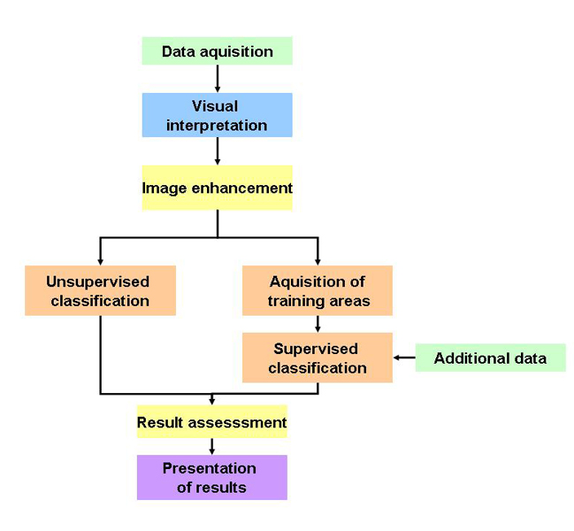
Changed after: Naumann 2008
Example of a classification from the SEOS tutorial Land Use und Land Use Change: Land Cover Classification of Tenerife 1978 and 2002
