2. Satellites
Satellite orbits
One possibility to distinguish between all earth observation satellite systems is to look at their orbits. Generally there are two major orbits which are called sun synchronous (or polar) and geostationary orbits.
Geostationary orbits are located about 36.000 km above the earth. At this altitude a satellite needs exactly 24 hours to orbit around the earth, the same time the earth takes to perform a complete revolution around its axis. The satellites "hover" at a right angle above the equator, therefore they seem to be stationary in the sky when seen from the earth. Hence, the satellites always "see" the same section of the earth surface and atmosphere.
For this reason, time lapse images can be produced visualising changes on the land surface or cloud movements. Due to the high altitude of the satellite orbit, the geometric resolution is very low. The smallest element that can be distinguished is about 1km2 wide.
METEOSAT is one example for a geostationary satellite. METEOSAT can take an image every 30 minutes. This high temporal resolution is a significant advantage when monitoring clouds and weather. Normally these geostationary satellites are used for weather monitoring and prediction as well as telecommunication and television broadcasting.

For the display of this element you need a Flash-Player from Version 8 on.


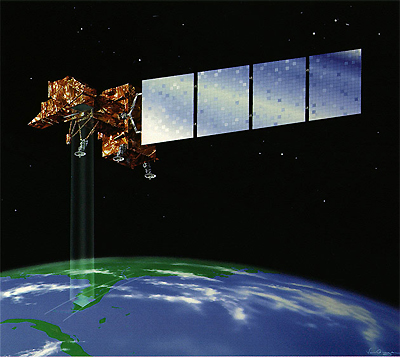
The other major orbit of earth observation satellites is the polar or sun synchronous orbit. Satellites in this orbit provide medium to high resolution images of the whole earth which are mostly used for environmental monitoring. They orbit at altitudes of 300 to 1.400 km above earth. With every satellite orbit which takes about 90 min, the earth is rotating a bit further resulting in the fact that the satellite is "watching" different sections of the earth in narrow bands. Days or weeks later, the satellite orbits again above the same section. Hence, the temporal resolution of these satellites is limited compared to geostationary satellites.
As satellites pass both polar regions with an inclination near 90° (angle between orbit and equatorial plane), their orbits are called polar orbits. The term sun synchronous means that the section monitored by the satellites is always radiated by the sun in the same way. The satellites always fly over a particular section always at a specific local time.Recording conditions stay constant and scenes from different time periods can be easily compared.
The US LANDSAT series is a well known example of a polar orbiting satellite.
For the display of this element you need a Flash-Player from Version 8 on.
Interesting link from NASA: J-Track 3D: Where are the satellites at the moment?
