4. The Productive Upwelling Regions
Upwelling
Chapter 3: the Global Conveyor described how water sinks in the North Atlantic to depth, beginning a journey through the deep ocean that lasts hundreds of years.
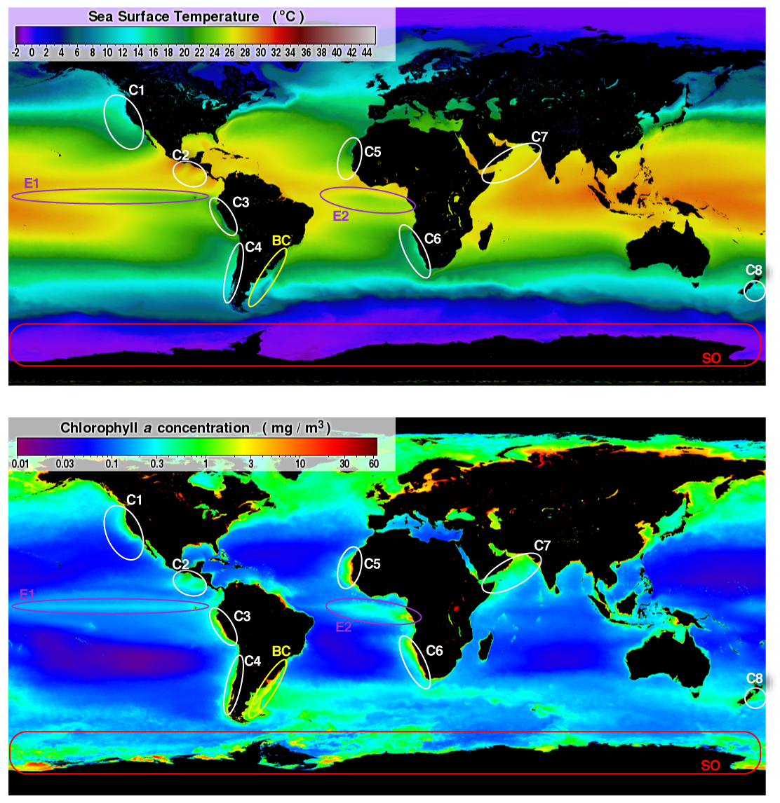
You may now wonder how the deep water comes back to the surface. This happens in locations where the flow of the surface currents makes room for the water below to come to the surface – to 'upwell'. The upwelled water is generally much colder than the surrounding surface waters, so it is easy to see in satellite images of sea surface temperature (SST).
Packed with nutrients
These upwelling areas are crucial for life in the ocean, as upwelled water is rich in nutrients like nitrogen and phosphorus compounds.
At depth, where there is no sunlight, these nutrients are of no use. But when upwelled water reaches the sun-lit zone, the nutrients allow the growth of phytoplankton, the tiny algal cells at the bottom of the marine food chain.
Phytoplankton are grazed by zooplankton, small animals that are in turn eaten by fish, so the upwelling regions support rich fisheries. They are among the most important ecosystems on the planet and a fundamental economic resource.
Satellites give us a handy overview of where upwelling happens. Everywhere, except in polar seas, the upwelling areas are characterized by sea surface temperatures that are lower than their surroundings and by higher phytoplankton concentrations (see images on the right).
The main coastal upwelling systems
Coastal upwelling occurs in regions where winds push surface water off-shore and is replaced by deeper water. There are a number of smaller upwelling regions around the world, but the main coastal upwelling systems are found on the eastern side of the ocean basins, next to the subtropical gyres of the Atlantic and Pacific, and associated with the cold eastern boundary current:
- The Canary Current upwelling system
- The Benguela Current upwelling system
- The California Current upwelling system
- The Peru Current upwelling system
Each support a rich ecosystem, and commercially important fisheries. These large marine ecosystems are increasingly under threat from over-exploitation, pollution and habitat modifications. One of these is the Benguela, described on the next page.
Spot the upwelling from space!