3. The High Latitidue 'Engine Rooms'
Two oceans
The surface ocean - the layer influenced by the wind - is in constant exchange with the atmosphere. Heat, moisture and gases such as oxygen and carbon dioxide flows between the two over periods of days to a few years.
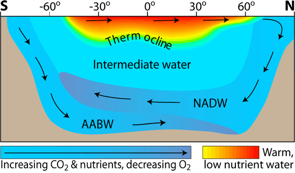
The surface ocean is only a few hundred metres deep. Beneath lies the deep ocean, where the water is very cold and dense. This prevents it changing place with surface water, which is much warmer and less dense.
Between the surface and deep ocean is the thermocline, a layer of water down to about 1000m, where the temperature decreases rapidly with depth.
The thermocline acts like a lid on the deep ocean, keeping the cold, CO2 -and nutrent-rich deep water from returning to the surface.
Deep water formation
Water in the deep ocean is very cold and dense. To replace it, surface water must be sufficiently salty and cold to match the density of the deep water.
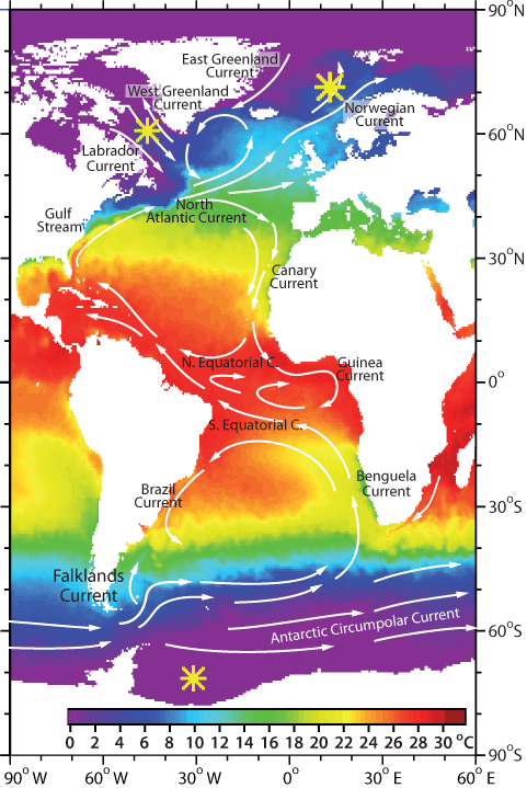
- Looking at the vertical structure of Atlantic water (above), at what latitudes does deep water form?
- How does this relate to the thermocline?
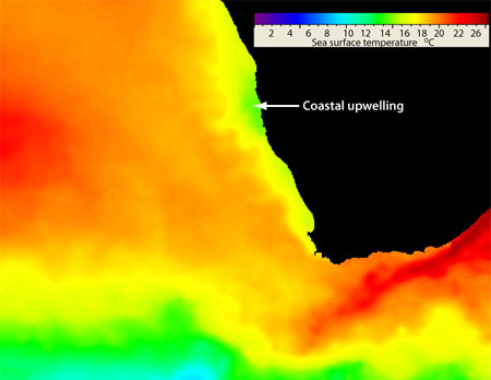
- The regions of deep water formation are indicated with a star on the maps of sea surface temperature (right). What are the typical surface temperatures in these areas, and how could you use this to explain the vertical positions of NADW and AABW in the Atlantic?
Sinking in the North Atlantic
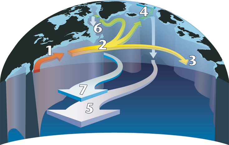
As the warm surface water from the Gulf Stream crosses the Atlantic, most of it turns south at about 40°N, but some continues towards the northwest (see figure).
Some of the water in this northern branch circles the subpolar gyre and enters the Labrador Sea where it sinks.
The eastern branch continues past Scotland, and starts to sink in the Nordic Seas - the ocean between Greenland, Iceland and Norway. This cold, dense North Atlantic Deep Water (NADW) returns south at depth.
Warming the Arctic
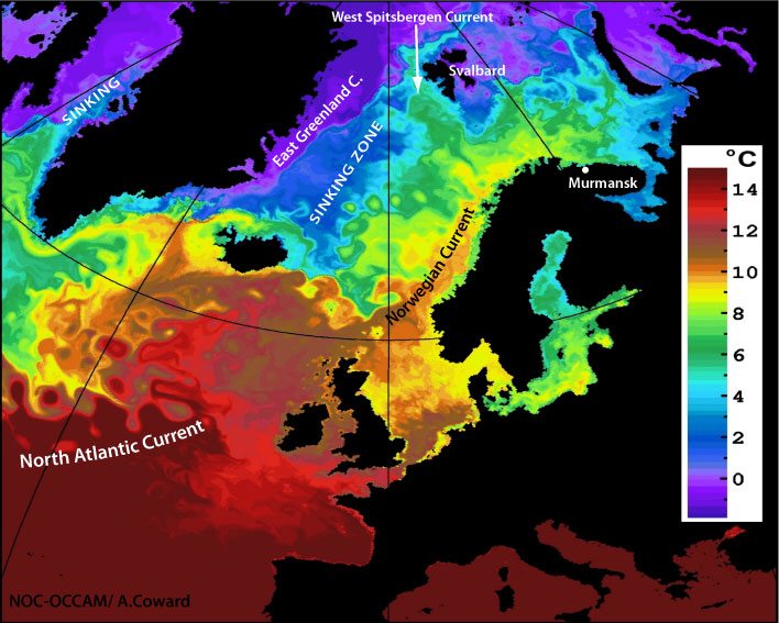
The last remains of the warm, salty water from the Gulf Stream flows on towards the Arctic. In the Barents Sea it is responsible for the ice free conditions in the Russian port of Murmansk.
A branch flows past Svalbard into the Arctic Ocean as the West Spitsbergen. In autumn and early winter the subtropical water of this current can be recognised on the surface by its warmth and high salinity to 80°N.
Sinking in the Southern Ocean
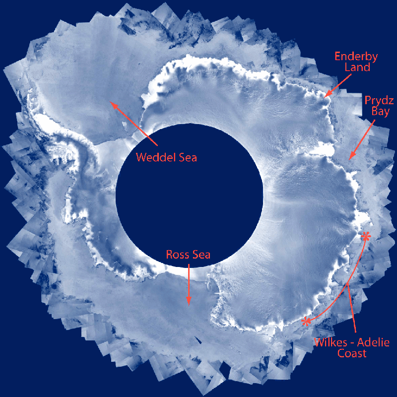
In the freezing temperatures of Antarctica cold dense water is created when surface water cools sufficiently to start freezing.
Ice contains almost no salt, so when it forms, it leaves behind a salty, sub-zero brine. The brine sinks, and on the way towards the bottom it mixes with slightly warmer intermediate water. The mixture becomes Antarctic Bottom Water (AABW), which flows northwards along the bottom in all the main oceans.
AABW can be recognized by its high salinity and very low temperature (less than 0°C).
Return to the surface
Deep water is mixed upwards in regions where currents diverge along the equator, where different currents meet or flow past each other, or where the flow is disrupted by submerged ridges and mounts.
The final return to the surface occurs in zones of upwelling and current divergence, and in the Southern Ocean where the thermocline breaks down.
