Change detection - Coral reefs now and then
Coastline changes
In the last decennia, human activities have had a great influence on the livability of coral reefs. At an increasing rate, extensive coral reefs have been destroyed.
The following image is a schematic representation of all changes that have occurred since 1987 around the city of Hurghada (Egypt).
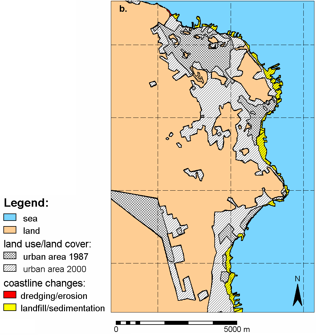
This picture clearly shows the rapid expansion of the city. But more important for coral reefs are the yellow spots along the coastline, which stand for 'landfill/sedimentation'. This means that in 1987, these places were sea and have now turned into land. Whole structures of coral reefs were destroyed in favour of cities, tourist resorts, harbours…
It is evident that these changes of coastlines are also detectable on satellite images!
But there is more…
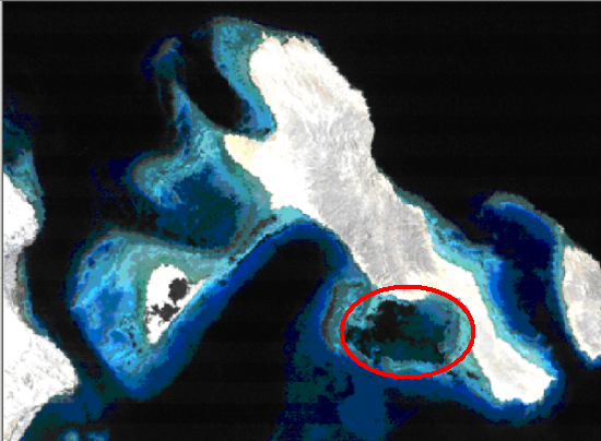
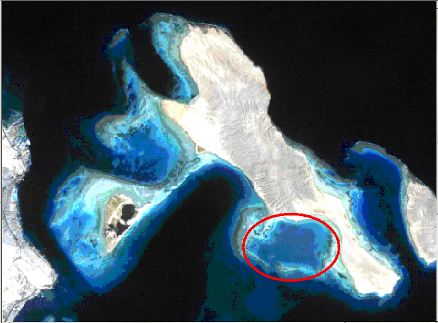
Not only coastline changes are detectable. Take a look at the following satellite images.
Source: Vanderstraeten, 2007.
Source: Vanderstraeten, 2007.
Comparing the image of 1987 (taken by Landsat 5 TM) with the image of 2000 (taken from the same area by Landsat 7 ETM+) shows that highly detectable changes have occurred: the encircled area used to be very dark in 1987 and is looking quite blue and light in 2000.
Two images of the same area, acquired at differents moments, can be compared to detect the changes that have occurred in the in-between period.
