Science Education through Earth Observation for High Schools (SEOS) is an initiative for using satellite remote sensing of the Earth in science education curricula in high schools.

The project was funded by the European Commission (EC). Implemented by 11 partners from European countries and in cooperation with the European Space Agency (ESA) it offers 17 tutorials on environmental and scientific topics. They cover many disciplines such as physics, biology, geography, mathematics and engineering, focusing on the interdisciplinary character of environmental education. They may also serve to improve language skills.

Your support in language translations would be warmly welcomed! We also appreciate any kind of feedback regarding suggestions for improvements. Please send your comments to Rainer Reuter.

Mathematical equations are mostly shown using the Mathematical Markup Language (MathML), which is supported by Mozilla Firefox and Safari Version 5.1 and newer. Internet Explorer requires installation of the MathPlayer Plug-in. MathML is not supported by Google Chrome, Opera, and Microsoft Edge, therefore equations are not correctly displayed using these browsers.

The SEOS eLearning tutorials:

*: in progress

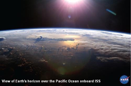
Cloud layers over the Pacific

in English

auf Deutsch

en français

Στα Ελληνικά

in Nederlands

باللغة العربية

em portuguès

en español

po polsku

на български

по-русски

türkçe

Remote Sensing
A World of Images
Eine Welt der Bilder
Un monde d'images
Ένας Κόσμος Εικόνων
Een wereld aan beelden
عالم من الصور
O Mundo em Imagens
         
Introduction to Remote Sensing
Einführung in die Fernerkundung
      مقدمة في الاستشعار عن بعد
Introdução ao Sensoriamento Remoto
  Wstęp do teledetekcji
Въведение в дистанционните изследвания
Введение в дистанционное зондирование
 
Geography
Natural and Cultural Heritages
Welterbestätten
Patrimoine naturel et culturel
Παγκόσμια Κληρονομιά
Werelderf-
goedsites

  Patrimônio Mundial
         
Coral Reefs
Korallenriffe
Récifs coralliens
  Koraalriffen
الشعاب المرجانية
Recife de Coral
         
Land Use and Land Use Change
Landnutzung und Landnutzungs-
wandel

  Χρήσεις Γης και Μεταβολές Χρήσεων Γης
Landgebruik en verandering in landgebruik
استخدامات الأراضى والتغير فى استخدامات الأرضى
Uso da Terra e Mudanças de Uso da Terra
         
Remote Sensing and GIS in Agriculture
Fernerkundung und GIS in der Landwirtschaft
Télédétection et SIG en agriculture
Τηλεπισκόπηση και GIS στην Γεωργία
Teledetectie en GIS in de landbouw
الإستشعار عن بعد ونظم المعلومات الجغرافية فى الزراعة
Sensoriamento Remoto e SIG em Agricultura
        Tarimda CBS ve Uzaktan Algilama
Natural Resource Management
Ressourcen-
management

Gestion des ressources naturelles
Διαχείριση Φυσικών Πόρων
Beheer van natuurlijke rijkdommen
إدارة الموارد الطبيعية
           
Physics, Biology, Chemistry, Environmental Sciences
Ocean Currents
Meeresströmungen
    Oceaanstromen
             
Ocean Colour
Meeresfarbe
  Το Χρώμα του Ωκεανού
Zeekleur
             
Marine Pollution
Verschmutzung der Meere
Pollution marine
Η Θαλάσσια Ρύπανση
Zeevervuiling
    Contaminación Marina
       
Understanding Spectra from the Earth*
Spektren der Erde*
Le spectre de la Terre*
  Inzicht in Spectra van de Aarde*
فهم الأطياف الضوئية من الأرض*
           
Remote Sensing Using Lasers*
Fernerkundung mit Lasern*
                   
Mathematics, Physics, Engineering, Environmental Sciences
3D models
3D-Modelle
Les modèles en 3D
3D-Μοντέλα
3D-modellen
             
Time Series Analysis*
Zeitreihenanalyse*
                   
Modelling of Environmental Processes
Modellierung von Umweltprozessen
Modélisation des processus environnementaux
                 
Classification
Klassifizierung
Classification
                 
Satellite Navigation with GPS
Satellitennavigation mit GPS
      GPS الملاحة عبر الأقمار الصناعية باستخدام
           
Imprint