How can satellites monitor land use change ?
In geography, land use is the description of how people utilize the land: fields ? pastures ? settlements ? forests ? etc.
Land use change means the variation in land use. Forest clearances, growth of cities and rehabilitation of former industrial sites are examples of land use change.
By comparing 2 satellite images acquired at different times, we can see the changes in land use.
You will find everything on how satellites study land use in the tutorial on
Land use and land use change !
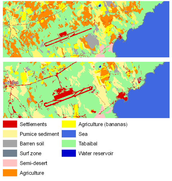
Land use change around the airport near El Médano (1978-1996), Tenerife.
Source: Naumann 2008. Click on the image to get the colour legend.
Source: Naumann 2008. Click on the image to get the colour legend.
