How was the classified image obtained ?
Basically, classified images are produced by computer calculations. The image pixels are grouped in different colour classes based on each pixel value.
A classified image offers a great view of the main surface cover types which aren't always discernable in the original image.
Check it out in the tutorials
Classification algorithms and methods
and Land use and land use change!
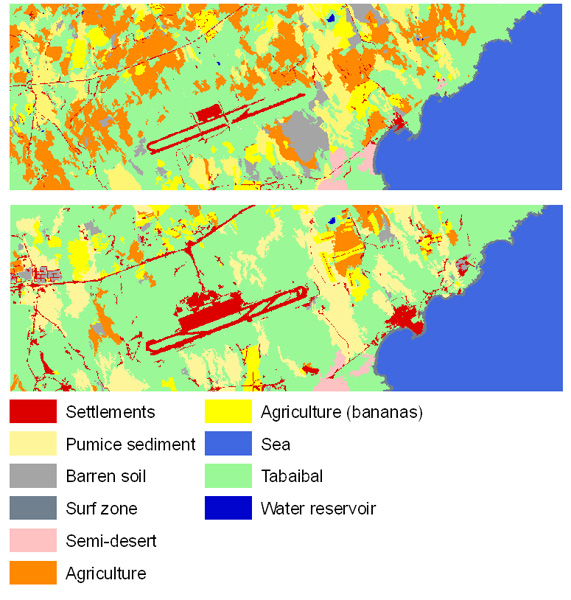
Land use change around the airport near El Médano (1978-1996), Tenerife.
Source: Naumann 2008. Click on the image to get the colour legend.
Source: Naumann 2008. Click on the image to get the colour legend.
