2. Water Management
Flooding
Rainfall or percipitation is an essential part of the water cycle. However, high intensity rain, can cause severe problems with soil erosion and flooding of rivers. When the amount of water added to the water exceeds the rate with which the river moves the water volume downstream, the level of the river rises, eventually over the elevation of the river banks, and floods the surrounding areas.

Source: Wikimedia Commons
Flooding destroys agricultural fields, as well as rural and urban structures. Large communities have been forced to relocate after a large flood, and whenever this was not possible, hunger and disease have caused fatalities.
Remote sensing is routinely used for the monitoring of natural hazards and provide snapsots of the situation before and after the hazard occuring. With frequently acquired data, the status can be closely monitored and estimates can be made on the amount of effort required to mitigate the effects of flooding, in this case.
Source: ESA
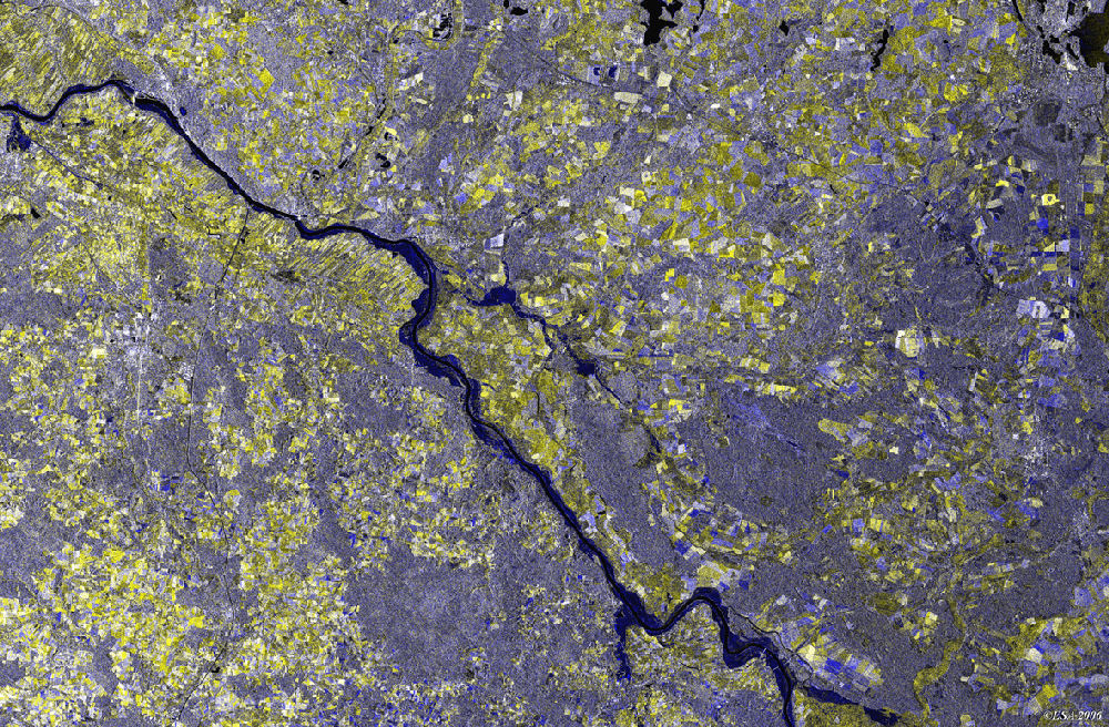
The image above is a multitemporal radar image (an image that shows the differences between two images taken at different times), of the Elbe river in Lower Saxony, Germany. The two original images that produced the above image were taken in July 2005 and April 2006, before and after the river flooded.

Source: NASA
Earlier that year, in May 2005, heavy rainfall at the Khasi Hills region of Bangladesh, resulted in flash floods occuring. Approximately 100,000 people were thought to have been affected by the floods. The two MODIS images above were taken 15 days apart and show the amount of water present before and after the flash floods.
Questions:
- By what percentage do you think the area covered by water increased between the two images?
- What is the area covered by water after the floods (in km2)?
- What is the problem with accurately estimating the area covered by water in the top image?
