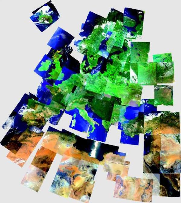
Composition of MERIS scenes of Europe.
Source: Beckel 2007
Source: Beckel 2007
Tasks
- Explain why we enhance data.
- Speculate how the satellite scenes in the image above were manipulated. Which type of image processing did they go through?
- Describe and interpret variations in colour between the different scenes.
a. What could the white spots above Iceland represent?
b. What might be the white areas in the Southern Mediterranean Sea?
- Speculate how the satellite scenes in the image above were manipulated. Which type of image processing did they go through?
