Southern Ocean Fronts
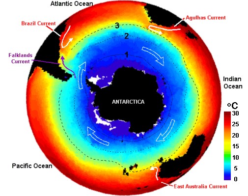
Measurements of temperature and salinity show several distinct zones in the Southern Ocean, each with its own type of water. Between the zones are fronts where water of different types meet and mix.
The fronts are particularly fertile zones, rich in phytoplankton during spring and summer. This means more food for marine animals, so the fronts are often feeding grounds for fish, birds, seals, whales and dolphins.
Fronts in ocean colour data

In satellite images of ocean colour the fronts are easy to spot because the chlorophyll concentrations there are higher than in surrounding areas.
In satellite images of sea surface temperature (SST) the fronts often show as bands where the temperature changes particularly fast. Temperature changes are particularly marked along the subtropical front - the boundary between cold polar water and the warm water of the subtropical ocean gyres.
Fronts in temperature data