Prevailing Winds
The unequal heating of the earth’s surface drives the prevailing winds. Warm air rises in the tropics and is replaced by air flowing in from higher latitudes. The zone where the winds converge, is known as the Inter-Tropical Convergence Zone (ITCZ); over the ocean this coincides with the region of highest sea surface temperatures.
High above the earth the air flows away from the ITCZ, cools and sinks at about 30 ° latitude. As it sinks, it forms the belt of sub-tropical highs - a band of very stable high-pressure systems. From these high-pressure regions the easterly Trade Winds blow towards the equator, meeting in the doldrums - an area of variable winds and sudden rain. This convection cell is known as the Hadley Cell.
Another cell, the Polar Cell, is formed when air rises in the sub-polar lows, travels towards the poles, sinks forming the polar high, and returns to the sub-polar lows as cold polar easterlies. Between these two lie the Ferrel Cell.
As air returns to the ITCZ from the Subtropical Highs, the flow turns to the right in the Northern Hemisphere and to the left in the Southern Hemisphere. As a result the returning flow, the easterly Trade Winds comes from an easterly direction in both hemisphere. The Coriolis effect also turns the winds blowing from the subtropical high towards subpolar lows at about 60 ° latitude, giving rise to a belt of winds from the west - the Westerlies.
There are three prevailing wind belts in each hemisphere,
- Tropical Easterlies: From 0-30 degrees latitude (Trade Winds).
- Prevailing Westerlies: From 30-60 degrees latitude (Westerlies).
- Polar Easterlies: From 60-90 degrees latitude.
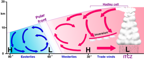
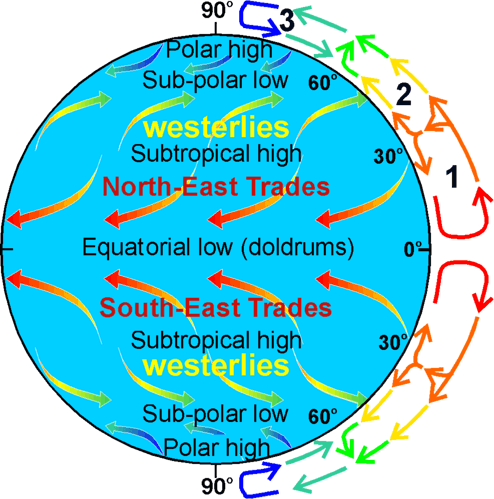 Diagram of the main wind belts.
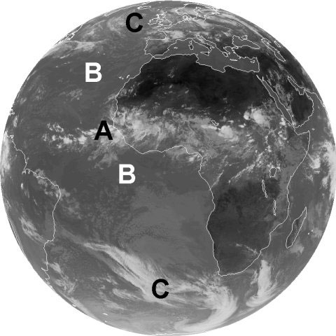 Meteosat infrared image with cloud patterns shaped by the wind belts
