Scenario
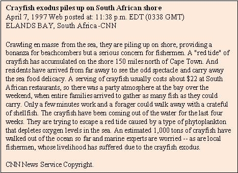
As you have learned from the news announcement above, a great amount of lobsters (in South Africa they are called crayfish) left the South Atlantic ocean to 'walk' out on the beach. This phenomenon has repeated several times in the following years since then.
You can help to protect the lobsters in the future!
This is what you can do:
- Find out why the lobsters left their habitat. What forced them to leave the ocean?
- Find out how to monitor the origin of danger using satellite remote sensing.
Materials:
- Worksheet "Lobster Escape"
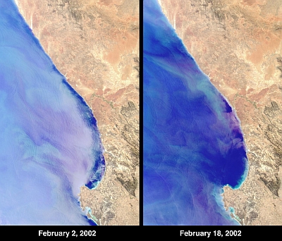
- Satellite images showing a red tide off the coast of South Africa on 2nd and 18th February 2002
- Background information

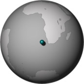
Location of Elands Bay, South Africa. The globe is centered at-40 degrees latitude and 10 degrees longitude.
Source: NASA/GSFC/LaRC/JPL, MISR Team |
Time needed:
- Two school lesson and one exercise for homework
Procedure:
- First lesson in class: Get together in groups of no more than 5 students. Discuss the questions about the lobster walkout and its monitoring
and decide which background information you may need to solve the problem. Assign a task to each member of your group which should be resolved by the
time of the next lesson in school. This should enable you to solve the given problem and present the results to your class.
Please note: not all the backgound information offered to you is needed to solve the problem! It's up to you to decide which information you may need. - Homework: Resolve the task that has been assigned to you by your group.
- Second lesson in class: present what you have learned to your group. Discuss how your findings can help you to answer the question of the
lobster walkout and its monitoring. Present your results to your class using the two satellite images of Elands Bay.
Background Information:
- Ecology of the rock lobster (Jasus lalandii)
- Natural enemies of the rock lobster (Jasus lalandii)
- Eutrophication
- Phytoplankton production
- Algae in the Oceans
- Ocean colour
- reflectance spectra
- Origin of the given satellite images
- Satellite orbits
- Oxygen concentration in Sea Water
- Near-shore tidal currents

