Supplément 3.2: SeaWiFS (en anglais)
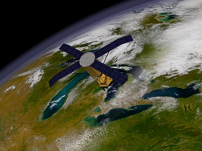
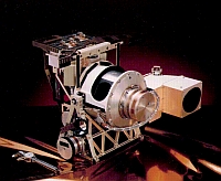
SeaWiFS stands for Sea-viewing Wide Field-of-View Sensor. It is an optical sensor on-board the OrbView-2 satellite (also called SeaStar) which is operated by the American company GeoEye. Launched 1st August 1997 the SeaWiFS instrument began scientific operations on 4th September 1997.
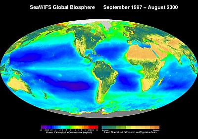
The SeaWiFS instrument has been specifically designed to monitor ocean characteristics such as chlorophyll-a concentration and water clarity. It thus looks at ocean colour.

Source: NASA
The SeaWiFS Mission is a part of NASA's Earth Science Enterprise, which is designed to look at our planet from space to better understand it as a system in both behaviour and evolution.
The instrument is able to tilt up to 20 degrees to avoid sunlight from the sea surface. This feature is important at equatorial latitudes where glint from sunlight often obscures water colour.
The spatial resolution of the SeaWiFS sensor is 1.1 km at nadir (looking straight down on the Earth). It records information in the following bands:
| Band | Wavelength | Colour |
|---|---|---|
| 1 | 402-422 nm | Violet |
| 2 | 433-453 nm | Blue |
| 3 | 480-500 nm | Blue |
| 4 | 500-520 nm | Green |
| 5 | 545-565 nm | Green |
| 6 | 660-680 nm | Orange |
| 7 | 745-785 nm | Near-Infrared |
| 8 | 845-885 nm | Infrared |
Mission characteristics
- Orbit Type: sun synchronous at about 705 km altitude
- Equator Crossing: noon +20 min, descending
- Orbital Period: 99 minutes
- Revisit Time: 1 day
Some interesting links about SeaWiFS
 |
||
| Where is SeaWiFs now? | Design your own SeaWiFS globe | The SeaWiFS project |

