Le fluorodétecteur à laser (5/5, en anglais)
The Laser Fluorosensor (5/5)
Combination with airborne multispectral scanner images
A comparison with other remote sensing instruments gives evidence of a few drawbacks of a laser fluorosensor: the laser requires much electric power and in aircraft this is available to a limited extent only. Therefore the laser pulse frequency is low and hence the geometric resolution on the ground is rather poor. The pixel distance in the oil spill images shown in the right column on the previous page is 10 m. They were measured with a laser fluorosensor having a 5 kW power consumption, which was about 50% of the total electric power available aboard the aircraft.
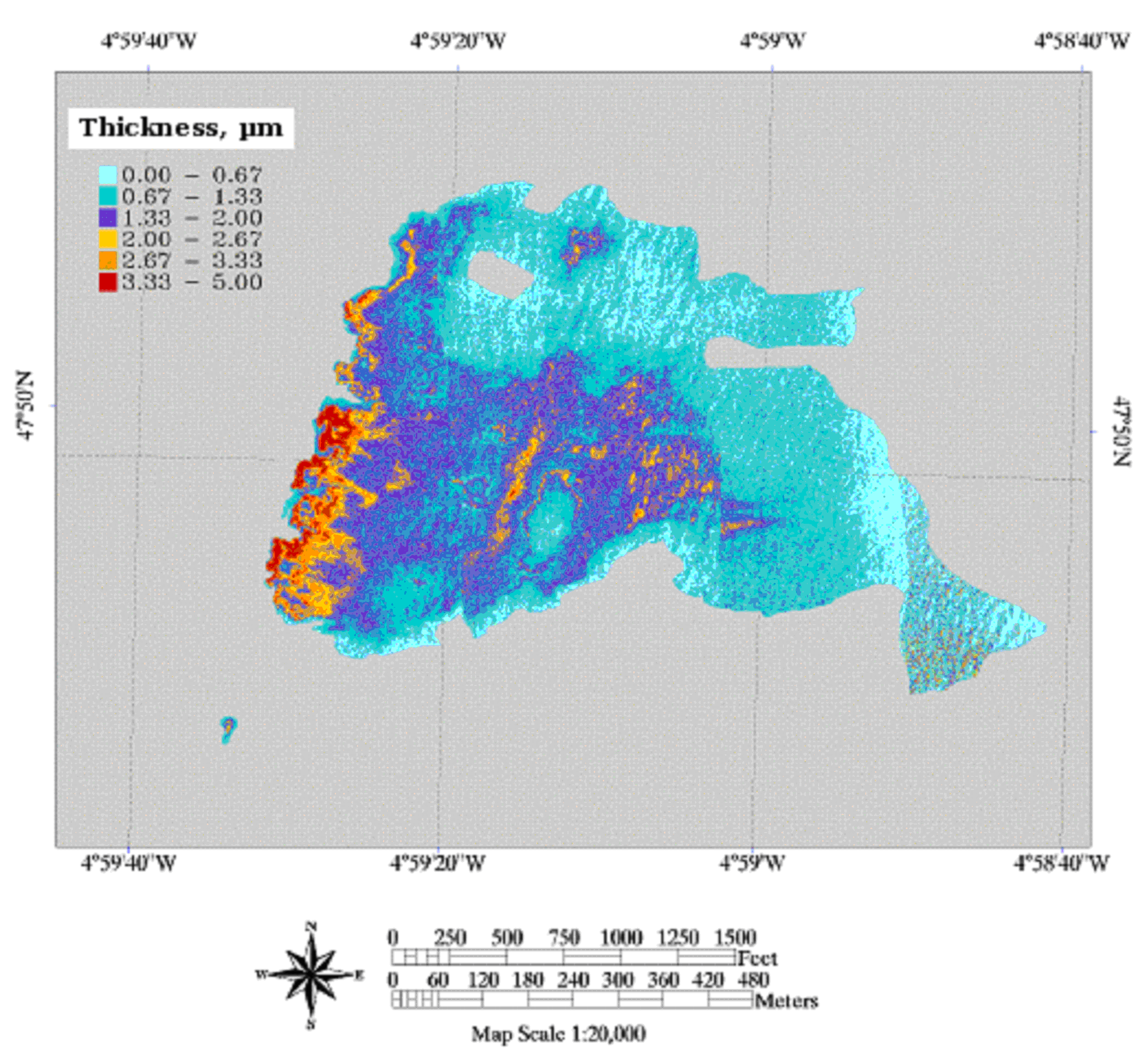
A way out of this problem can be to combine the laser fluorosensor data - with poor geometric resolution but quantitative in terms of oil film thickness and oil type - with the data of other sensors having a much better geometric resolution. A good candidate (during daylight) is the multispectral scanner, an instrument performing a line scan of the ground at a number of different wavelengths. Its images display oil slicks with good geometric resolution like a colour photo but they can be interpreted in qualitative terms only. A combination - also denoted as data fusion - results in highly resolved quantitative images!
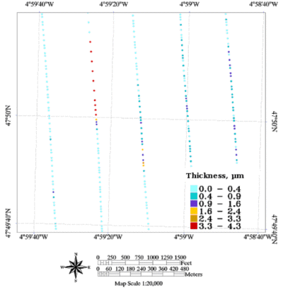
Right: Colour composite of images obtained with a multispectral scanner during five transects from above the same oil spill.
Source: EARSeL eProceedings
Source: EARSeL eProceedings
The fusion of data from different sensors taken from the same scene at the same time can provide very detailed and quantitative information.
