Supplement 2.4: Natural Oil Seeps
What are they?
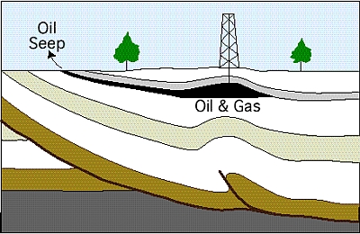
Oil and gas seeps are natural springs where liquid and gaseous hydrocarbons (hydrogen-carbon compounds) leak out of fissures in eroding
sedimentary rock or in the ocean seabed. Whereas freshwater springs are fed by underground pools of water, oil and gas seeps are fed by natural
underground accumulations of oil.
Natural oil seeps are used in identifying potential petroleum reserves.
Source: US Geological Survey
Oil that leaks to the Earth's surface is eventually transformed from a clear fluid to a tar-like substance called asphaltum.
The lighter components of the oil are lost to evaporation, and the remaining heavier oil is oxidised and degraded by bacteria
until it becomes sticky and black.
Where do they occur?
Natural seeps occur both onshore (on land; see photograph on the left) and offshore (on the sea floor; see photograph on the right).
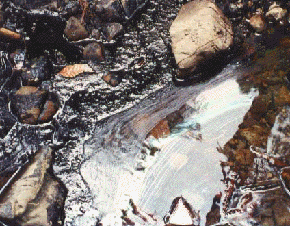
Natural oil seep at Tar Water Creek in the Santa Cruz Mountains, California, USA.
Photo: US Geological Survey |
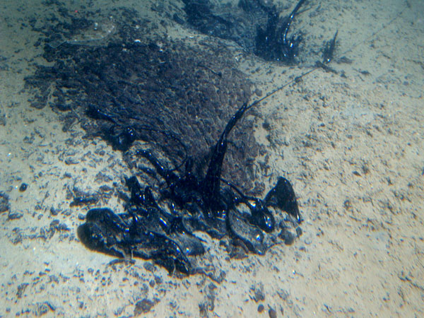
Natural tar seep offshore Gaviota, California, in approximately 60 m water depth.
Photo: Donna Schroeder, MMS |
Natural seepage of hydrocarbons occurs in various coastal areas located around eroded sedimentary basins or faults between plates
of the Earth's crust.
This is the case in particular on the coasts of Alaska, California, the Gulf of Mexico, the Red Sea, the Caspian Sea
and Borneo Island, where sheen and oil slicks are regularly seen independently of any pollution caused by humans.
Fate and behaviour of oil from offshore seeps
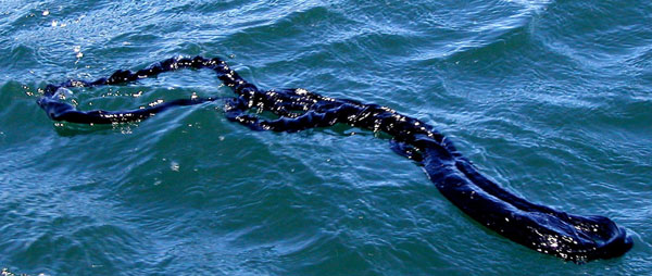
Oil from offshore seeps at first ends up floating on the water surface. Depending on its amount, composition and degree of weathering, the oil will take up different appearances that range from a light sheen to a slick or thick mats of tar as can be seen in the photographs below.
|
|
|
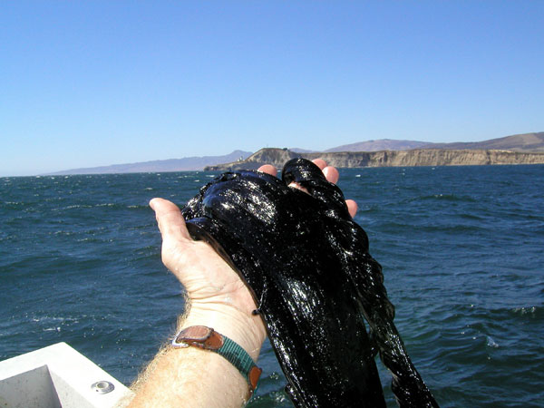
Tar found floating in the ocean offshore Point Conception, California. Photo: US Geological Survey |
|
Leaks of oil from fields below the ocean can serve both as an exploration indicator and as a source of environmental damage.
How much oil is released from natural seeps?
The actual amount of oil that is released to the environment from natural seeps is very difficult to distinguish since oil tends to spread quickly in the sea water.
According to a study conducted by the National Research Council (NRC) of the U.S. National Academy of Sciences (NRC ), natural oil seeps contribute
the highest amount of oil to the marine environment, accounting for 46% of the annual load to the world's oceans.
Other studies agree on an estimated total of around 250,000 tonnes per year of seepage from natural sources for the period 1990-2000,
which represents 10% of all oil released into the marine environment.
However, no exhaustive inventory of natural seepage locations exists and this figure could therefore be out by a factor of ten (Cedre 2007).
Remote sensing of offshore oil seeps
Oil seeps and slicks can remain intact on the surface and may be detectable in visible and near infrared (VIR / NIR) as well as in radar imagery. The methods for detection are the same as for oil spills caused under human influence (see Remote sensing and oil spills).
The best studied offshore oil seep is the region off Coal Oil Point in the Santa Barbara Channel of California shown in the image below.
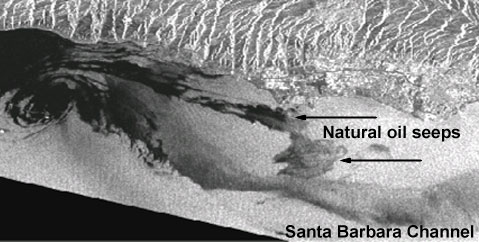
Source: NASA (interpretation and caption; Image source: ESA)
