7. Water Analysis Using Lidar
Measurement of natural properties of water (3/3)
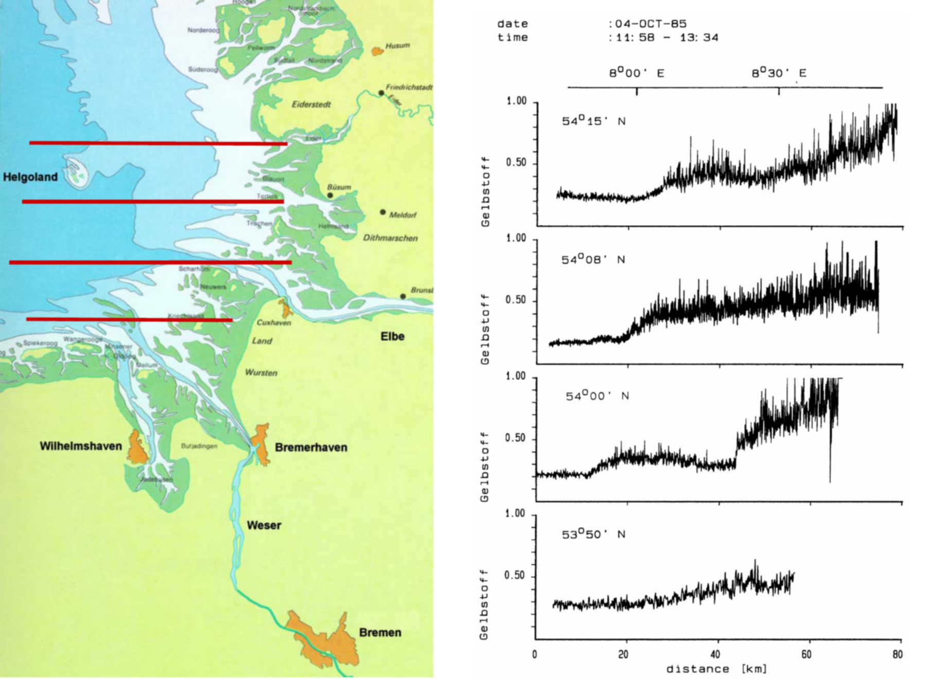
The graphs below show four west-to-east transects of the German Bight where measurements were taken with a laser fluorosensor onboard an aircraft. The flight altitude was 200 m, the distance between the measuring points on the water surface was 10 m. As described in the previous page, two lasers with emission wavelengths 308 nm and 450 nm were used to measure the Raman scattering of the water and the fluorescence emissions of gelbstoff and chlorophyll.
Based on the data, three water types which are clearly separated from one another by river discharge fronts can be identified:
- the outflow of the River Elbe which causes high attenuation and high gelbstoff signals along the coast of Schleswig-Holstein
- going westwards, an area with high attenuation and gelbstoff signals where Elbe water mixes with sea water
- in the west, an area with low attenuation and gelbstoff signals: the open waters of the German Bight.

