Credits van beeldmateriaal
Inleiding
Tenerife
Source: Naumann S, 2008
Modellierung der Siedlungsentwicklung auf Tenerife (Kanarische Inseln). Eine fernerkundungsgestützte Analyse zur Bewertung des touristisch induzierten Landnutzungswandels.
In: Heidelberger Geographische Arbeiten, 125:
180 pp.
Satellite image of the shore of Dubai, September 2003
Source: NASA Aster
http://asterweb.jpl.nasa.gov/gallery-detail.asp?name=Dubai
Last access: 13.08.2009
Satellite image of the shore of Dubai, November 2004
Source: NASA
http://earthobservatory.nasa.gov/IOTD/view.php?id=37632
Last access: 13.08.2009
Satellite image of the shore of Dubai, September 2006
Source: NASA Aster
http://asterweb.jpl.nasa.gov/gallery-detail.asp?name=palmislands
Last access: 13.08.2009
Satellite image of the shore of Dubai, February 2009
Source: NASA
http://earthobservatory.nasa.gov/IOTD/view.php?id=37632
Last access: 13.08.2009
Massentourismus/Teneriffa
Source: Naumann S, 2008
Modellierung der Siedlungsentwicklung auf Tenerife (Kanarische Inseln). Eine fernerkundungsgestützte Analyse zur Bewertung des touristisch induzierten Landnutzungswandels.
In: Heidelberger Geographische Arbeiten, 125:
180 pp.
1. Wereldwijde verandering in landgebruik
Global Distribution of Land Cover 2000
Source: University of Texas
http://www.utexas.edu/features/graphics/2008/water/water4.jpg/
Last access: 06.08.2009
Potential Vegetation Distribution
Source: NASA LCLUC
http://lcluc.umd.edu/images/Science_Themes/Foley1-large.jpg/
Last access: 06.08.2009
Percent Distribution of Land Cover 2000
Own illustration, Source: Schinninger 2008.
Globale Landnutzung
(Zürich, Berlin)
http://www.wbgu.de/wbgu_jg2008_ex09.pdf.
Last access: 09.02.2009
Land Use Change
Own illustration, Source: Goldewijk, Battjes 1997:
A Hundred Year Database for Integrated Environmental Assessments.
National Institute of Public Health and the Environment.
Bilthoven.
Land Use Change caused by Urbanisation and Mass Tourism
Own illustration, Source: NASA Visible Earth.
http://visibleearth.nasa.gov/view_rec.php?id=1438
Last access: 01.09.2009
2. Verstedelijking
Shanghai
Source: Wikimedia
http://de.wikipedia.org/w/index.php?title=Datei:Shanghaihectorgarcia.jpg
Last access: 13.08.2009
Mexico City
Source: Wikimedia
http://en.wikipedia.org/wiki/File:Mexico_DF_City.jpg
Last access: 10.03.2009
Johannesburg
Source: Wikimedia
http://de.wikipedia.org/w/index.php?title=Datei:Joburg_top.jpg
Last access: 13.08.2009
Urbanisation
Source: Bundeszentrale für politische Bildung
http://www.bpb.de/wissen/6ODQKG,0,0,Verst%E4dterung.html
Last access: 13.08.2009
World at day
Source: Beckel L, 2007
The European Space Agency Schulatlas: Geography from Space
(Salzburg: Geospace)
287 pp.
World by night
Source: NASA Visible Earth
http://visibleearth.nasa.gov/view_rec.php?id=1438
Last access: 11.08.2009
Population density
Source: Beckel L, 2007
The European Space Agency Schulatlas: Geography from Space
(Salzburg: Geospace)
287 pp.
Cities with 1 million people or more in 1825
Own illustration, Source: Soja E & M Kanai, 2007:
The Urbanization of the World.
In: The endless city, edited by R Burdett (Phaidon),
54-69.
Cities with 1 million people or more in 1900
Own illustration, Source: Soja E & M Kanai, 2007:
The Urbanization of the World.
In: The endless city, edited by R Burdett (Phaidon),
54-69.
Cities with 1 million people or more in 1950
Own illustration, Source: Soja E & M Kanai, 2007:
The Urbanization of the World.
In: The endless city, edited by R Burdett (Phaidon),
54-69.
Cities with 1 million people or more in 2005
Own illustration, Source: Soja E & M Kanai, 2007:
The Urbanization of the World.
In: The endless city, edited by R Burdett (Phaidon),
54-69.
The largest cities in 1950, 1985 and 2005
Own illustration, Source: Soja E & M Kanai, 2007:
The Urbanization of the World.
In: The endless city, edited by R Burdett (Phaidon),
54-69.
The Urbanisation of the World
Own illustration, Source: Beckel L, 2007; Soja E & M Kanai, 2007:
The Urbanization of the World.
In: The endless city, edited by R Burdett (Phaidon),
54-69.
Urbanisation in North America
Own illustration, Source: Beckel L, 2007; Soja E & M Kanai, 2007:
The Urbanization of the World.
In: The endless city, edited by R Burdett (Phaidon),
54-69.
Urbanisation in America
Source: Seed Magazine
http://seedmagazine.com/content/article/state_of_the_planet/
Last access: 13.08.2009. These graphics were created for Seed magazine’s State of the Planet issue, April/May 2006, Volume 2, Issue 4. seedmagazine.com. Included here by permission.
Urbanisation in Middle and South America
Own illustration, Source: Beckel L, 2007; Soja E & M Kanai, 2007:
The Urbanization of the World.
In: The endless city, edited by R Burdett (Phaidon),
54-69.
Urbanisation in Europe
Own illustration, Source: Beckel L, 2007; Soja E & M Kanai, 2007:
The Urbanization of the World.
In: The endless city, edited by R Burdett (Phaidon),
54-69.
Urbanisation in Africa
Own illustration, Source: Beckel L, 2007; Soja E & M Kanai, 2007:
The Urbanization of the World.
In: The endless city, edited by R Burdett (Phaidon),
54-69.
Film: Revisiting Cairo
Source: UNFPA, 2008
http://video.unfpa.org/?v=7979820245233415482007
Last access: 01.09.2009
Urbanisation in Asia
Own illustration, Source: Beckel L, 2007; Soja E & M Kanai, 2007:
The Urbanization of the World.
In: The endless city, edited by R Burdett (Phaidon),
54-69.
What about Shanghai?
Source: Wikimedia
http://de.wikipedia.org/w/index.php?title=Datei:Shanghaihectorgarcia.jpg
Last access: 13.08.2009
Urbanisation in Oceania
Own illustration, Source: Beckel L, 2007; Soja E & M Kanai, 2007:
The Urbanization of the World.
In: The endless city, edited by R Burdett (Phaidon),
54-69.
Comparison of urban growth rates
Source: Own illustration, Blotevogel H H, 2003
http://www.uni-duisburg.de/FB6/geographie/Studium/Lehrveranstaltungen/SS2003/ Blotevogel/Grundlagen-Humangeographie-KuSo/06Verstaedterung.pdf, (Universität Duisburg-Essen, Fachgebiet Wirtschaftgeographie)
Last access: 22.10.2008
Urbanisation in Sydney
Source: NASA Aster
http://veimages.gsfc.nasa.gov/2889/sydney_AST2001oct12_lrg.jpg
Last access: 13.08.2009
Satellite image of Los Angeles
Source: NASA
http://asterweb.jpl.nasa.gov/gallery-detail.asp?name=LA
Last access: 06.08.2009
Los Angeles at night seen from space
Source: NASA Visible Earth
http://earthobservatory.nasa.gov/IOTD/view.php?id=3352
Last access: 06.08.2009
Los Angeles on a map
Source: University of Texas
http://www.lib.utexas.edu/maps/california.html
Last access: 06.08.2009
3-D perspective view
Source: NASA Visible Earth
http://visibleearth.nasa.gov/view_rec.php?id=2574
Last access: 06.08.2009
Astronaut photograph of LA at night
Source: NASA Visible Earth
http://earthobservatory.nasa.gov/IOTD/view.php?id=8708
Last access: 06.08.2009
Perspective image of Los Angeles
Source: NASA Visible Earth
http://earthobservatory.nasa.gov/IOTD/view.php?id=3067
Last access: 06.08.2009
Mexico City 1973 and 2000
Source: UNEP
http://na.unep.net/atlas/webatlas.php?id=140
Last access: 06.08.2009
Population density of Mexico City
Source: The Urban Age Project
http://www.urban-age.net/10_cities/_data/data_UAC.html
Last access: 06.08.2009
Flyby over Mexico City
Source: NASA / Goddard Space Flight Center
http://visibleearth.nasa.gov/view_rec.php?id=9560
Last access: 06.08.2009
Haze over Mexico City
Source: NASA Visible Earth
http://visibleearth.nasa.gov/view_rec.php?id=3419
Last access: 11.08.2009
Atmospheric inversion over Mexico City
Source: Appleby M, 2007:
Luftverschmutzung der Megastadt Mexiko-Stadt.
In: Diercke 360° (2)
8-11.
Mexico City under a pall of smog
Photo: Carlos Oscar Ruiz
http://homepage.mac.com/helipilot/PhotoAlbum31.html
Last access: 13.08.2009
Haze over Mexico City
Photo: Carlos Oscar Ruiz
http://homepage.mac.com/helipilot/PhotoAlbum31.html
Last access: 13.08.2009
Blue sky over Mexico City?
Photo: Carlos Oscar Ruiz
http://homepage.mac.com/helipilot/PhotoAlbum31.html
Last access: 13.08.2009
Mexico City at night
Photo: Carlos Oscar Ruiz
http://homepage.mac.com/helipilot/PhotoAlbum31.html
Last access: 13.08.2009
London in 2005 and 2001
Source: NASA Visible Earth
http://earthobservatory.nasa.gov/IOTD/view.php?id=3200
http://earthobservatory.nasa.gov/IOTD/view.php?id=5481
Last access: 13.08.2009
Population density of London
Source: The Urban Age Project
http://www.urban-age.net/10_cities/_data/data_UAC.html
Last access: 13.08.2009
London Low Emission Zone Road signs
Source: Transport for London
http://www.tfl.gov.uk/roadusers/lez/zone/6758.aspx
Last access: 13.08.2009
Johannesburg
Source: Wikimedia
http://de.wikipedia.org/w/index.php?title=Datei:Joburg_top.jpg
Last access: 13.08.2009
Johannesburg
Source: NASA Visible Earth
http://visibleearth.nasa.gov/view_rec.php?id=16595
Last access: 13.08.2009
Johannesburg in 1896
Source: Wikipedia
http://de.wikipedia.org/w/index.php?title=Bild:Earlytown.jpg
Last access: 13.08.2009
Map of Johannesburg from the CIA, 1977
Source: University of Texas
http://www.lib.utexas.edu/maps/world_cities/johannesburg_77.jpg
Last access: 13.08.2009
Mumbai November 2006
Source: NASA Visible Earth
http://earthobservatory.nasa.gov/IOTD/view.php?id=7376
Last access: 11.08.2009
Population density of Mumbai
Source: The Urban Age Project
http://www.urban-age.net/10_cities/_data/_Den/Den_MBI.html
Last access: 11.08.2009
Satellite image of Mumbai, July 2002
Source: NASA Visible Earth
http://visibleearth.nasa.gov/view_rec.php?id=3424
Last access: 11.08.2009
Part of Agra, India
Source: IKONOS Satellite Image provided by GeoEye and Satellite Imaging Corporation
http://www.satimagingcorp.com/gallery/ikonos-new-delhi-india-taj-mahal.html
Last access: 11.08.2009
Slum in Rio
Photo: Andreas Nilsson
http://www.flickr.com/photos/andreasnilsson1976/375995825/
Last access: 11.08.2009
Comparison between city and slum population
Own illustration, Source: Claaßen K, 2008:
Die Stadt. Diercke Spezial
(Braunschweig)
128 pp.
Housing in Jakarta, Indonesia
Photo: Jonathan McIntosh
http://commons.wikimedia.org/wiki/File:Jakarta_slumhome_1.jpg
Last access: 11.08.2009
Stream within a slum
Photo: Wikimedia
http://upload.wikimedia.org/wikipedia/commons/e/e8/Slum_and_dirty_river.jpg
Last access: 11.08.2009
The city of the future?
Source: Nextconceptcars.com
http://www.nextconceptcars.com/worldwide-news/in-30-years-the-cars-wont-need-any-drivers/
Last access: 11.08.2009
The ecological footprint of London
Source: Own illustration, Data: London.gov.uk
http://london.gov.uk/
Last access: 13.08.2009
... people are living on our planet right now
Source: Deutsche Stiftung Weltbevölkerung
Last access: 01.09.2009
Natural annual increase
Source: Wikimedia
http://commons.wikimedia.org/wiki/File:Population_growth_rate_2007-de.svg
Last access: 17.08.2009
Proportion of urban population by region, 1950-2030
Source: UN-HABITAT
http://www.unhabitat.org/
Last access: 17.08.2009
Rural and urban population by region in 2005 and 2030
Source: UN-HABITAT
http://www.unhabitat.org/
Last access: 17.08.2009
Megacities with 5, 8 and 10 million inhabitants in the year 2000
Source: Kraas F, 2003:
Megacities as Global Risk Areas.
In: Petermanns Geographische Mitteilungen, 147 (4):
6-15.
Megacities with 5, 8 and 10 million inhabitants in the year 2015
Source: Kraas F, 2003:
Megacities as Global Risk Areas.
In: Petermanns Geographische Mitteilungen, 147 (4):
6-15.
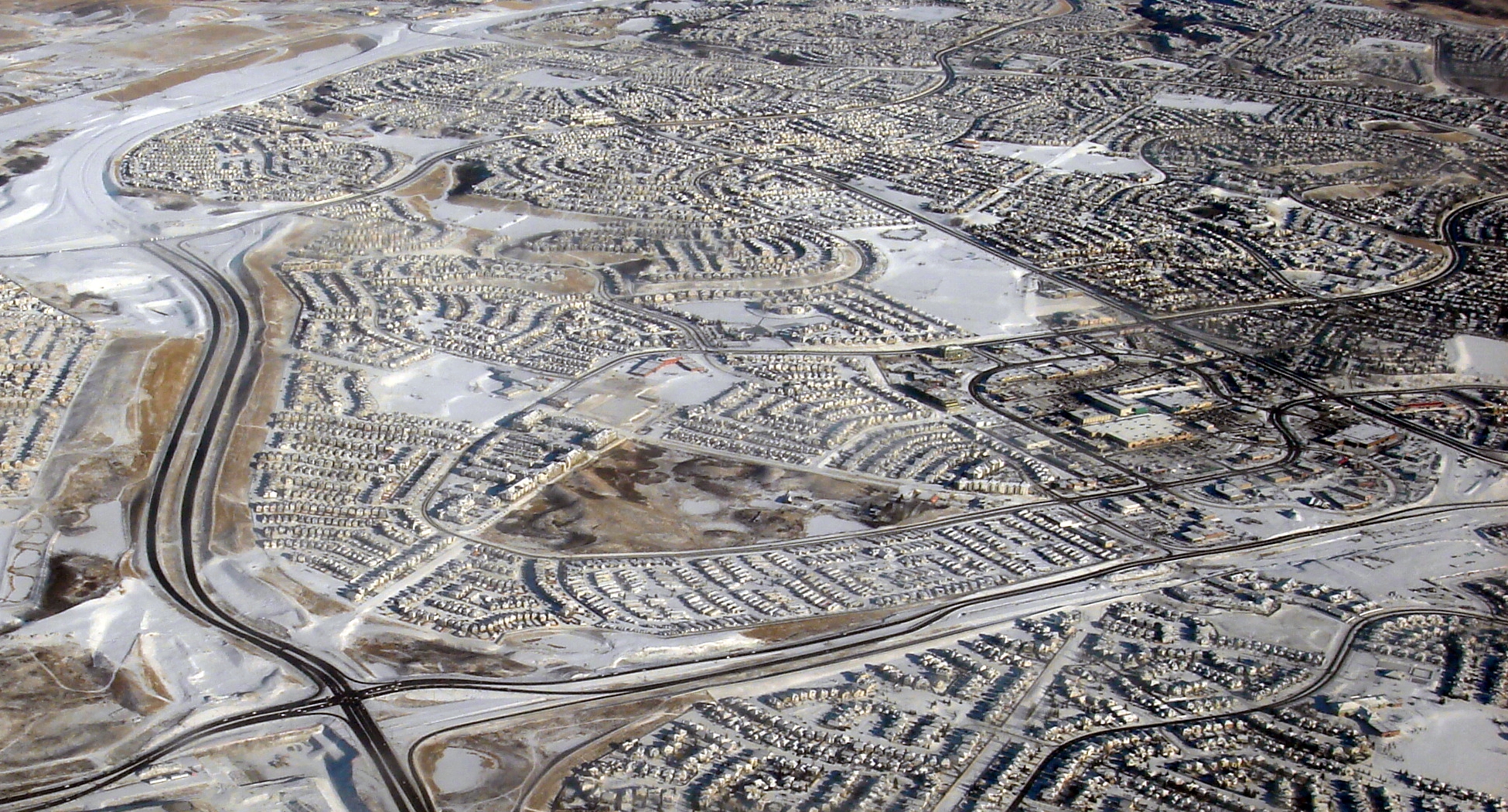
Canadian Suburb
Source: Wikimedia
http://upload.wikimedia.org/wikipedia/commons/a/af/Arbor_Lake-Aerial.JPG
Last access: 17.08.2009
Urban sprawl
Source: Windows on our World
http://woow.phil-sllvn.co.uk/windows/
Last access: 17.08.2009
Entrance to a guarded gated community in Canada
Source: Wikipedia
http://en.wikipedia.org/wiki/File:Saskatoon_gated_community.JPG
Last access: 17.08.2009
Welcome to heaven
Source: Chet Haase
http://chetchat.blogspot.com/2007_04_01_archive.html
Last access: 17.08.2009
Money buys freedom
Source: Andrew Singer
http://www.funnytimes.com/cotw/cotw20021218.php
Last access: 17.08.2009
Urban growth in the world's largest cities, 1950-2020
Source: UN-HABITAT
http://www.unhabitat.org/
Last access: 17.08.2009
New York
Source: NASA
http://earthobservatory.nasa.gov/IOTD/view.php?id=3678
Last access: 17.08.2009
Paris
Source: NASA Aster
http://asterweb.jpl.nasa.gov/gallery-detail.asp?name=Paris
Last access: 17.08.2009
Tokyo
Source: NASA Aster
http://asterweb.jpl.nasa.gov/gallery-detail.asp?name=Tokyo
Last access: 17.08.2009
Film 1: Seeking the Good Life in Guangdong
Source: UNFPA, 2008
http://video.unfpa.org/?v=72642592562157281572007
Last access: 01.09.2009
Film 2: A Teenage Mother in Manila's Slums
Source: UNFPA, 2008
http://video.unfpa.org/?v=81346542362211411572007
Last access: 01.09.2009
Film 3: Rural Migrants Toil in Ho Chi Minh City
Source: UNFPA, 2008
http://video.unfpa.org/?v=15737117862216001572007
Last access: 01.09.2009
Weltkarte mit Megacities
Source: Wikipedia
http://de.wikipedia.org/wiki/Stumme_Karte
Last access: 02.09.2009
&
Soja E & M Kanai, 2007:
The Urbanization of the World.
In: The endless city, edited by R Burdett (Phaidon),
54-69.
3. Syndromen van mondiale verandering
Forest in Rondônia 1972
Source: Beckel L, 2007
The European Space Agency Schulatlas: Geography from Space
(Salzburg: Geospace)
287 pp.
The same area in Rondônia 1986
Source: Beckel L, 2007
The European Space Agency Schulatlas: Geography from Space
(Salzburg: Geospace)
287 pp.
... and in 2000
Source: Beckel L, 2007
The European Space Agency Schulatlas: Geography from Space
(Salzburg: Geospace)
287 pp.
Carbonised Tree Trunks for a Cattle Ranch in Brazil
Photo: D027500 - © Werner Rudhart/Greenpeace
http://www.greenpeace.de/themen/waelder/nachrichten/artikel/ist_amazonien_noch_zu_retten/ansicht/bild/4/
Last access: 17.08.2009
Fire Clearance in the Amazon
Photo: D015749 - © C. Plowden/Greenpeace
http://www.greenpeace-muenchen.de/THEMEN/WALD/UrwaldAmazonas.shtml
Last access: 17.08.2009
Aggradation of the Aral Sea, 1964
Source: Beckel L, 2007
The European Space Agency Schulatlas: Geography from Space
(Salzburg: Geospace)
287 pp.
Aggradation of the Aral Sea, 1973
Source: UNEP
http://na.unep.net/atlas/webatlas.php?id=11
Last access: 17.08.2009
Aggradation of the Aral Sea, 1986
Source: UNEP
http://na.unep.net/digital_atlas2/webatlas.php?id=11
Last access: 01.09.2009
Aggradation of the Aral Sea, 1989
Source: NASA Earth Observatory
http://earthobservatory.nasa.gov/IOTD/view.php?id=3730
Last access: 17.08.2009
Aggradation of the Aral Sea, 2000
Source: Beckel L, 2007
The European Space Agency Schulatlas: Geography from Space
(Salzburg: Geospace)
287 pp.
Aggradation of the Aral Sea, 2003
Source: NASA Earth Observatory
http://earthobservatory.nasa.gov/IOTD/view.php?id=3730
Last access: 17.08.2009
Aggradation of the Aral Sea, 2006
Source: ESA
http://earth.esa.int/cgi-bin/satimgsql.pl?show_url=1476
Last access: 17.08.2009
Climate Graph of Aralsk
Source: www.klimadiagramme.de
http://klimadiagramme.de/Asien/aralskoemore.html
Last access: 24.08.2009
The Escondida pit 1989
Source: UNEP
http://na.unep.net/atlas/webatlas.php?id=98
Last access: 24.08.2009
The Escondida pit 2000
Source: UNEP
http://asterweb.jpl.nasa.gov/gallery-detail.asp?name=Escondida
Last access: 24.08.2009
The Escondida pit 2000 in an IR satellite image
Source: UNEP
http://asterweb.jpl.nasa.gov/gallery-detail.asp?name=Escondida
Last access: 24.08.2009
The Escondida pit 2003
Source: UNEP
http://earth.esa.int/cgi-bin/satimgsql.pl?show_url=1476
Last access: 24.08.2009
The Region Almeria 1974
Source: UNEP
http://na.unep.net/atlas/webatlas.php?id=172
Last access: 01.09.2009
The Region Almeria 2004
Source: UNEP
http://na.unep.net/atlas/webatlas.php?id=172
Last access: 01.09.2009
Cultivation Methods in the Region Almeria: Green Houses and Hydroponics
Source: UNEP
http://na.unep.net/atlas/webatlas.php?id=172
Last access: 01.09.2009
The aggradation of the Aral Sea in fast motion
Source: Aviso
http://www.aviso.oceanobs.com/en/newsstand/altimetry-applications-in-videos/aral-sea/index.html
Last access: 24.08.2009
Aggradation of the Aral Sea between 1973 and 2000
Source: Beckel L, 2007
The European Space Agency Schulatlas: Geography from Space
(Salzburg: Geospace)
287 pp.
Land Cover Change between 1973 and 2000
Source: Beckel L, 2007
The European Space Agency Schulatlas: Geography from Space
(Salzburg: Geospace)
287 pp.
The Shrinking of the Aral Sea 1973 - 1986 - 2006
Source: UNEP & ESA
http://na.unep.net/atlas/webatlas.php?id=11
&
http://na.unep.net/atlas/webatlas.php?id=11
&
http://earth.esa.int/cgi-bin/satimgsql.pl?show_url=1476
Last access: 27.08.2009
4. Massatoerisme
The potential future growth of settlements
on the island of Tenerife
Source: Naumann S, 2008
Modellierung der Siedlungsentwicklung auf Tenerife (Kanarische Inseln). Eine fernerkundungsgestützte Analyse zur Bewertung des touristisch induzierten Landnutzungswandels.
In: Heidelberger Geographische Arbeiten, 125:
180 pp.
Simulated settlement cells in the year 2026
Source: Naumann S, 2008
Modellierung der Siedlungsentwicklung auf Tenerife (Kanarische Inseln). Eine fernerkundungsgestützte Analyse zur Bewertung des touristisch induzierten Landnutzungswandels.
In: Heidelberger Geographische Arbeiten, 125:
180 pp.
Classification of Tenerife of 1978
Source: modified after Naumann S, 2008
Modellierung der Siedlungsentwicklung auf Tenerife (Kanarische Inseln). Eine fernerkundungsgestützte Analyse zur Bewertung des touristisch induzierten Landnutzungswandels.
In: Heidelberger Geographische Arbeiten, 125:
180 pp.
Classification of Tenerife of 2002
Source: modified after Naumann S, 2008
Modellierung der Siedlungsentwicklung auf Tenerife (Kanarische Inseln). Eine fernerkundungsgestützte Analyse zur Bewertung des touristisch induzierten Landnutzungswandels.
In: Heidelberger Geographische Arbeiten, 125:
180 pp.
The Canary Islands
Source: Wikipedia
http://de.wikipedia.org/w/index.php?title=Datei:Canarias_NASA2.jpg
Last access: 24.08.2009
Climatic influences
Source: University of California, Santa Barbara, Geography
http://www.geog.ucsb.edu/~jeff/wallpaper2/page3.html
Last access: 01.09.2009
Location
Source: NASA Visible Earth
http://visibleearth.nasa.gov/view_detail.php?id=1608
Last access: 24.08.2009
Climate chart of Santa Cruz, in North-East of Tenerife
Source: Own illustration, Data: AEMET
http://www.aemet.es/es/portada
Last access: 01.09.2009
Vegetation zoning of Tenerife
Source: Naumann S, 2008
Modellierung der Siedlungsentwicklung auf Tenerife (Kanarische Inseln). Eine fernerkundungsgestützte Analyse zur Bewertung des touristisch induzierten Landnutzungswandels.
In: Heidelberger Geographische Arbeiten, 125:
180 pp.
Allocation game: Volcano, Laurel forest, Shrub vegetation, Pine trees, Succulents & Mountain semi-desert
Source: Naumann S, 2008
Modellierung der Siedlungsentwicklung auf Tenerife (Kanarische Inseln). Eine fernerkundungsgestützte Analyse zur Bewertung des touristisch induzierten Landnutzungswandels.
In: Heidelberger Geographische Arbeiten, 125:
180 pp.
Allocation game: Moutain range, fertile valley & beach
Source: Wikipedia
http://de.wikipedia.org/wiki/Teneriffa
Last access: 01.09.2009
Temperature distribution on Tenerife
Source: Naumann S, 2008
Modellierung der Siedlungsentwicklung auf Tenerife (Kanarische Inseln). Eine fernerkundungsgestützte Analyse zur Bewertung des touristisch induzierten Landnutzungswandels.
In: Heidelberger Geographische Arbeiten, 125:
180 pp.
Percipitation distribution on Tenerife
Source: Naumann S, 2008
Modellierung der Siedlungsentwicklung auf Tenerife (Kanarische Inseln). Eine fernerkundungsgestützte Analyse zur Bewertung des touristisch induzierten Landnutzungswandels.
In: Heidelberger Geographische Arbeiten, 125:
180 pp.
Map of altitudinal zones on Tenerife
Source: Naumann S, 2008
Modellierung der Siedlungsentwicklung auf Tenerife (Kanarische Inseln). Eine fernerkundungsgestützte Analyse zur Bewertung des touristisch induzierten Landnutzungswandels.
In: Heidelberger Geographische Arbeiten, 125:
180 pp.
Map of exposition on Tenerife
Source: Naumann S, 2008
Modellierung der Siedlungsentwicklung auf Tenerife (Kanarische Inseln). Eine fernerkundungsgestützte Analyse zur Bewertung des touristisch induzierten Landnutzungswandels.
In: Heidelberger Geographische Arbeiten, 125:
180 pp.
1880 - 1900
Source: after Naumann S, 2008
Modellierung der Siedlungsentwicklung auf Tenerife (Kanarische Inseln). Eine fernerkundungsgestützte Analyse zur Bewertung des touristisch induzierten Landnutzungswandels.
In: Heidelberger Geographische Arbeiten, 125:
180 pp &
Gebhardt et al. S, 2007
Geographie.
(München, Heidelberg):
1096 pp
1880 - 1960
Source: after Naumann S, 2008
Modellierung der Siedlungsentwicklung auf Tenerife (Kanarische Inseln). Eine fernerkundungsgestützte Analyse zur Bewertung des touristisch induzierten Landnutzungswandels.
In: Heidelberger Geographische Arbeiten, 125:
180 pp &
Gebhardt et al. S, 2007
Geographie.
(München, Heidelberg):
1096 pp
1880 - 1975
Source: after Naumann S, 2008
Modellierung der Siedlungsentwicklung auf Tenerife (Kanarische Inseln). Eine fernerkundungsgestützte Analyse zur Bewertung des touristisch induzierten Landnutzungswandels.
In: Heidelberger Geographische Arbeiten, 125:
180 pp &
Gebhardt et al. S, 2007
Geographie.
(München, Heidelberg):
1096 pp
1880 - 2006
Source: after Naumann S, 2008
Modellierung der Siedlungsentwicklung auf Tenerife (Kanarische Inseln). Eine fernerkundungsgestützte Analyse zur Bewertung des touristisch induzierten Landnutzungswandels.
In: Heidelberger Geographische Arbeiten, 125:
180 pp &
Gebhardt et al. S, 2007
Geographie.
(München, Heidelberg):
1096 pp
Countries of origin of the tourists on Tenerife 2006
Own illustration, Source: ISTAC
http://www2.gobiernodecanarias.org/istac/estadisticas.html
Last access: 01.09.2009
Employer Tourism
Source: Own illustration, Data: Weidner W, 2002
Diercke Erdkunde BW, Kursstufe.
(Westermann, Braunschweig).
Worldwide tourist flows
Source: Own illustration, Data: Weidner W, 2002
Diercke Erdkunde BW, Kursstufe.
(Westermann, Braunschweig).
Above France
Source: NASA Visible Earth
http://visibleearth.nasa.gov/view_rec.php?id=6575
Last access: 24.08.2009
Above the English Channel
Source: NASA Visible Earth
http://visibleearth.nasa.gov/view_rec.php?id=6142
Last access: 24.08.2009
Increasing tourist figures worldwide
Source: BPB
http://www.bpb.de/wissen/2OW091,0,0,Tourismusverkehr.html
Last access: 27.08.2009
The globalised tourism
Source: Tourism Watch
http://www.tourism-watch.de/fix/37/hotel.gif
Last access: 01.09.2009
International tourist arrivals according to world regions:
present development and forecast.
Source: UNTWO
http://www.unwto.org/facts/eng/vision.htm
Last access: 27.08.2009
Annual international tourist arrivals according to world regions
Source: UNTWO
http://www.unwto.org/facts/eng/vision.htm
Last access: 27.08.2009
Beach extract from Bibione, Italy
Source: Beckel L, 2007
The European Space Agency Schulatlas: Geography from Space
(Salzburg: Geospace)
287 pp.
Part of the club facility Robinson Club Agadir
Source: Robinson
http://www.robinson.com/
Last access: 27.08.2009
International air traffic from and to Germany
Source: Destatis
http://www.destatis.de/jetspeed/portal/cms/Sites/destatis/Internet/DE/Grafiken/Publikationen/STATmagazin/Umwelt/Flugverkehr,templateId=renderLarge.psml
Last access: 27.08.2009
The travel star as a opertionalised concept "sustainable travel"
Source: Hopfinger H, 2007
Geographie der Freizeit und des Tourismus.
In: Geographie, edited by H Gebhardt, R Glaser, U Radtke & P Reuber (München, Heidelberg)
713-733. Mit freundlicher Genehmigung von Spektrum Akademischer Verlag.
Simulated conditions for summer tourism in Europe for 1961-1990
Source: Peseta
http://peseta.jrc.ec.europa.eu/docs/Tourism.html
Last access: 27.08.2009
Simulated conditions for summer tourism in Europe for 2071-2100
Source: Peseta
http://peseta.jrc.ec.europa.eu/docs/Tourism.html
Last access: 27.08.2009
Compilation of land coverage and land use classes from 2002
of classes from 1978
Source: Naumann S, 2008
Modellierung der Siedlungsentwicklung auf Tenerife (Kanarische Inseln). Eine fernerkundungsgestützte Analyse zur Bewertung des touristisch induzierten Landnutzungswandels.
In: Heidelberger Geographische Arbeiten, 125:
180 pp.
Land use change around the airport near El Médano
Source: Naumann S, 2008
Modellierung der Siedlungsentwicklung auf Tenerife (Kanarische Inseln). Eine fernerkundungsgestützte Analyse zur Bewertung des touristisch induzierten Landnutzungswandels.
In: Heidelberger Geographische Arbeiten, 125:
180 pp.
Composition of land cover and land use category
of 1996 for El Médano out of the categories of 1978.
Source: Naumann S, 2008
Modellierung der Siedlungsentwicklung auf Tenerife (Kanarische Inseln). Eine fernerkundungsgestützte Analyse zur Bewertung des touristisch induzierten Landnutzungswandels.
In: Heidelberger Geographische Arbeiten, 125:
180 pp.
Advertising for a holiday on Tenerife
Source: Canarias
http://www.tourspain.es/de/
Last access: 27.08.2009
Development of the intensity of holiday trips between
1954 and 2004 and the intensity of the short holiday trips between
1970 and 2004 in Germany
Source: Hopfinger H, 2007
Geographie der Freizeit und des Tourismus.
In: Geographie, edited by H Gebhardt, R Glaser, U Radtke & P Reuber (München, Heidelberg)
713-733. Mit freundlicher Genehmigung von Spektrum Akademischer Verlag.
High resolution satellite image of the Vatican
Source: IKONOS Satellite Image provided by GeoEye and Satellite Imaging Corporation
http://www.satimagingcorp.com/gallery/ikonos-vatican-city-rome.html
Last access: 27.08.2009
