Remote Sensing of Natural Heritage Sites
Virunga National Park (2/2)
Contribution of Remote Sensing:
Defining the borders of protected areas
The concept of "protected area" implies a certain legislation that ensures the protection of a natural heritage site. However, in developing countries, most of the natural heritage sites, although they are protected, only have the legislation on-paper. For example, for certain protected areas in the Democratic Republic of Congo, the text of creation for the protected area describes the borders of the site:
"From a point starting at the north shore of Lake Kivu and from the eastern border of the lava flow from volcano Rumoka; followed by the western side of the lava flow just at the beginning of the hill known as Nyamutsibu..."
Clearly, such a vague definition brings legal problems since it becomes very difficult for a conservation authority to sustain any argument against someone that has invaded the natural heritage site: how to prove that there is an invasion?
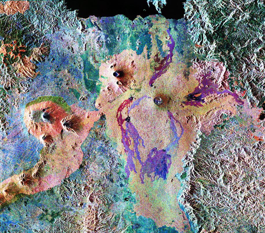
Satellite imagery is particularly useful to monitor habitat. In this example, LANDSAT is observing the Virunga mountains. The satellite can capture an image of this area each 18 days providing a unique source of information to detect changes and to observe eventual threats. One natural heritage in the Virunga mountains is called 'Bwindi impenetrable forest', this indicates the difficulties for humans to enter into the park and observe the park as a whole. This is where satellite imagery can help us to provide an overview as seen from above.
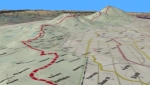
The following animation illustrates the use of optical satellite data fused with SRTM (radar) data in order to automatically
derive topography for the World Heritage sites in the Virunga Mountains.
Please pay particular attention to the maps
derived from satellite images.
Click on the image to start (opens in a new browser window or player)
Deriving from satellite images, accurate cartography for natural heritage sites
Remote sensing becomes extremely useful to assist in the definition of the borders for a natural heritage site. Satellite images can be automatically corrected and when combined with other type of sensors (e.g. SRTM topographic data) the image itself can be orthorectified. The result is an extremely accurate cartographic satellite image compatible with GPS devices. Such an image constitutes already an accurate map where the conservation authorities can, without any problem, define the protected area borders.
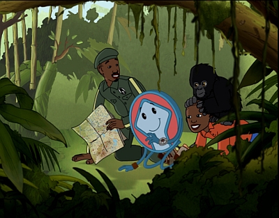
Preserving World Heritage through Education
In 2002 a cartoon series entitled Patrimonito's World Heritage Adventures was launched where
Patrimonito introduces World Heritage sites, the threats they are facing and proposes solutions to preserve them.
The cartoon films which are based on storyboards made 'by young people for young people' are proving to be useful teaching
support materials. They are becoming popular at events held by UNESCO.