Introduction: World Heritage Sites from Space to Place
How can remote sensing help to protect World Heritage Sites?
1. Detecting and monitoring change
By comparing satellite images aquired at different times we can study changes, such as for example deforestation. Remote sensing can be a valuable tool in understanding emerging threats to heritage sites. It can also be used to follow-up whether conservation measures have been effective or not.
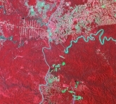
LANDSAT image, Iguazu, 1973
Source: NASA |
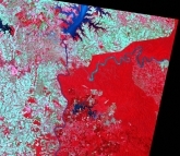
LANDSAT image, Iguazu, 1986
Source: NASA |
The two false colour Landsat images above, for example, have been used to study landscape changes around the World Heritage National Park of Iguazu in Argentina.
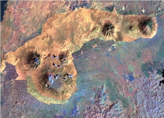
2. Creating maps
Conservation of world heritage sites often necessitates the availability of accurate maps. Especially for large scale, remote areas such as the National Parks of central Africa maps are needed to define the protected borders and to enable the local population to undertake the corresponding law enforcement to assist in the conservation of the site.

Source: ESA
3. Improving communication
Satellite images are also used a means to improve the information flow and communication among site managers and conservation authorities. An image is often much easier to interpret and much more intuitive than a written text.
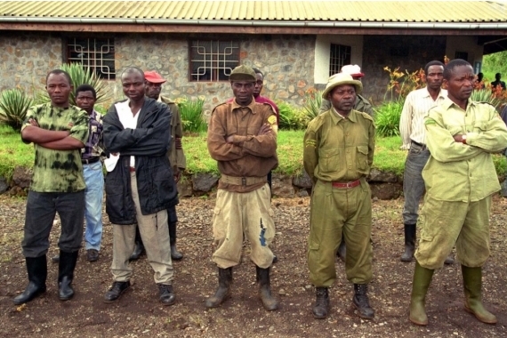
Photo: UNESCO
4. Analysing supraregional environmental changes
Supraregional environmental changes and human induced activities may have an impact on World Heritage Sites. Remote sensing can be a powerful tool in detecting and monitoring these changes and influences and thus enabling the decision makers to plan appropriate conservation measures.
Source: UNESCO
