1. Space and its Dimensions
What are the advantages of mapping in 3D?
Three dimensional representations, diverted from satellite images, can be very useful for a lot of subjects:
Aircraft pilots require accurate topographic information for flight planning and navigation.

Source: Wikimedia Commons

Source: Wikimedia Commons
The military requires precise topographic information for training and real time operations.

Source: Wikimedia Commons
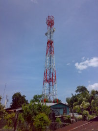
Knowing the exact height and location of mountain peaks enables the cellular phone industry to place towers for signal reception in optimal locations .
Source: Wikimedia Commons
Topographic maps are the mainstay of day hikers and back packers.
Source: United States Geological Survey
Source: Wikimedia Commons
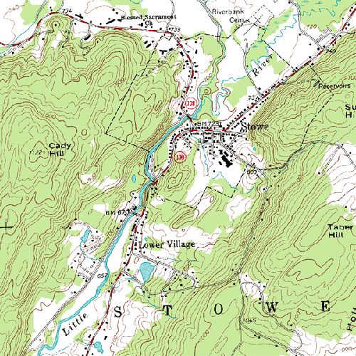
City planners use topographic data to help locate suitable places for structures or recreation.
But what is a topographic map?
Have you ever seen a map that shows not only the location of features on the Earth, but also how high or low they are? This information is known as topography, and maps which display elevation information are called topographic maps.
For various parts of the world, topography maps are limited, inaccurate or nonexistent. For example, many mountain chains, inhospitable deserts and tropical rain forests have totally inadequate topographic coverage. This is mainly due to the difficulty in getting to these locations. Even where topographic maps exist, they may have been created only for specific purposes. Neighbouring countries may generate topographic data using entirely different methods. This lack of standardization effectively limits the scope of regional or global studies where accurate topography is essential.
3D in other industries
Of course there are other applications of 3D that have nothing to do with topographic information:
- Television and film industry: think about the films Titanic and Jurassic Park.
- In the medical world where 3D helps to map out every detail of the human body.
- Industry: in designing car prototypes, for example.
- Games
- ...
